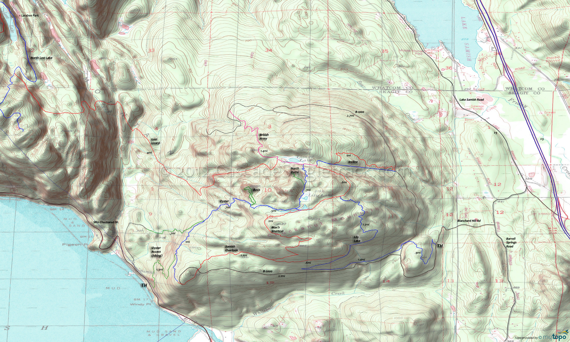
Blanchard Hill Area Mountain Biking and Hiking Topo Map
Map includes: British Army Trail, Incline Trail, Lily Lake Trail, Lost Lizard Trail, Max's Shortcut Trail, North Butte Trail, Oyster Trail, Rock Trail, Samish Overlook Trail Mountain Biking and Hiking Trails.
TH: Directions are from the Lower Link TH. Alternate is to start from the end of B2000. Climb .8mi to B1000 then pick up Lily Lake Tr and climb to Max's Shortcut, passing the Samish Overlook Tr intersection at 2.2mi. Creek crossing and wetlands at 2.4mi. Bear right to stay on the trail, then cross a small bridge at 2.9mi.
3.7mi: Cross bridge then go right at Max's Shortcut. Descend to the British Army/Incline intersection and continue .1mi on British Army to Oyster. If you reach Lizard Lake, enjoy the view for a few minutes, then turn around and try to find the Oyster intersection again.
4.4mi: Oyster passes Lily Lake, then descends 1000' in 1mi over terrain too rough for most riders. Just past the large boulder, the descent moderates and becomes rideable again.
6.1mi: Pass the Oyster Lower trail intersection and continue on the main trail. Cross creeks at 5.9mi, 6.3mi and 6.5mi (and descend some steps) then reach Samish Overlook.
7mi: Reach Blanchard Hill B-2000, then taking Samish Overlook, ascending a small hill (passing Max's Shortcut at 8mi) then descending to Lily Lake.
8.5mi: Go (sharply) right onto Lilly Lake and to the TH.
Draggable map: Map window adjusts to screen size and will respond to touch control. Use scrollbar for mouse control.
No Map? Browser settings and some browser extensions can prevent the maps from appearing. Please see Site Tech


