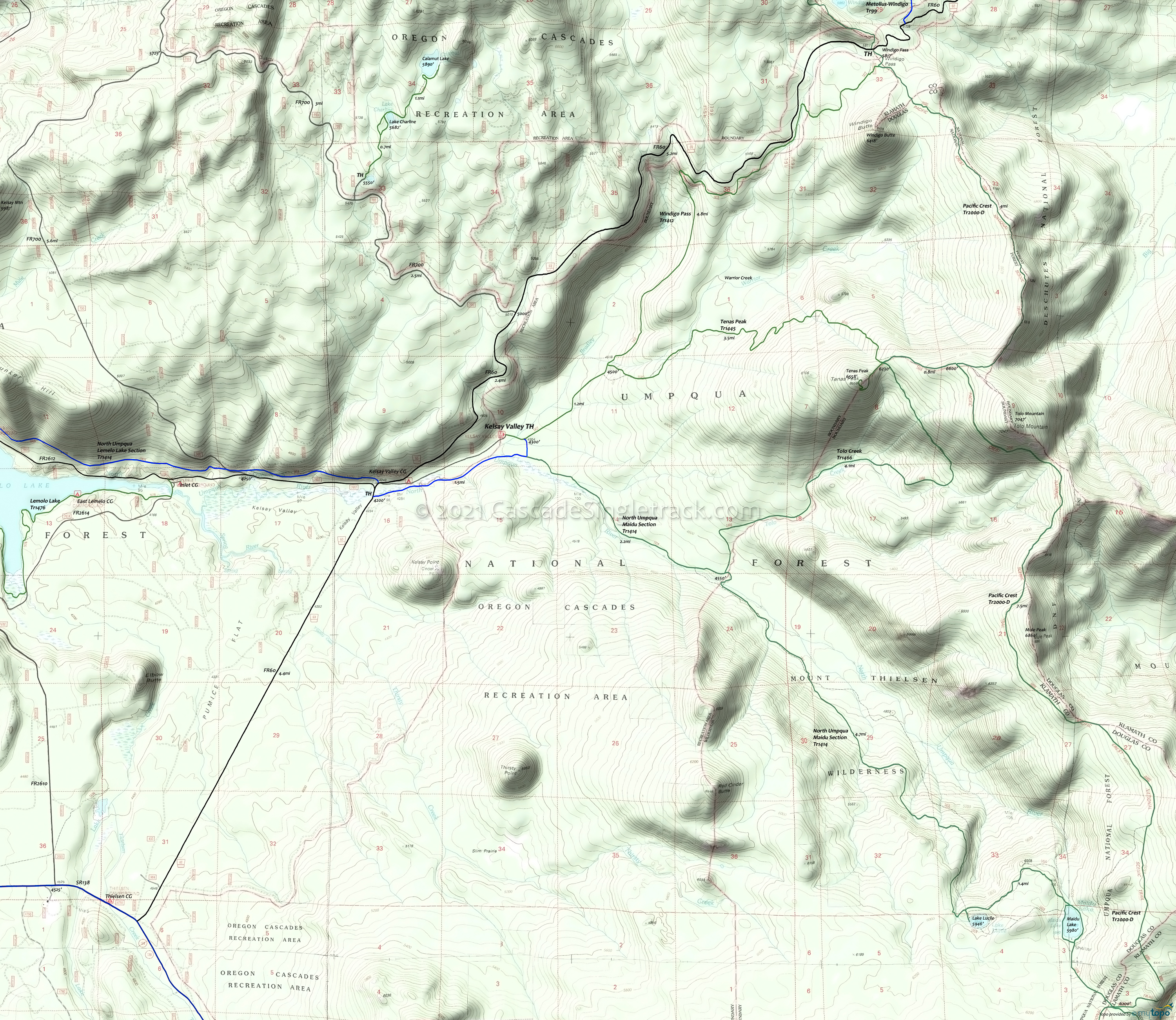
North Umpqua Trail 1414: Maidu Lake Hiking Topo Map
Map Includes: Maidu Lake Trail 1414, Pacific Crest Trail 2000-D, Calamut Lake Trail 1494, Windigo Pass Trail 1412, Tenas Peak Trail 1445, Tolo Creek Trail 1466 and Watson Butte Hiking Trails.
The first mile of trail from Kelsay Valley Trailhead follows the river as it meanders through a broad, grassy flat.
At 2.7 miles, near the Tolo Creek Tr1466 junction, the trail enters Mount Thielsen Wilderness. Ascend toward Lake Lucile and Maidu Lake, over 7700 year old pumice deposits from the eruption of Mt. Mazama, which created Crater Lake.
From Maidu Lake, the Digit Point TH is 4.75 miles to the east at Miller Lake in Fremont-Winema National Forest.
The Pacific Crest National Scenic Tr2000-D junction with North Umpqua Trail is about 1 mile southeast of Maidu Lake.
Both Lake Lucile and Maidu Lake are stocked with fingerling trout. Lake Lucile covers 9 acres and averages a depth of 15 feet. Maidu Lake, the source of the North Umpqua River, averages a depth of 12 feet and covers 20 acres.
Tolo Creek Tr1466 ascends through stands of lodgepole pine and true fir. Several intermittent streams are crossed. The trees become more widely spaced, allowing occasional views of Lemolo Lake, Mt. Bailey and Tenas Peak.
Be prepared for hoards of mosquitos during the late spring and early summer months.
Draggable map: Map window adjusts to screen size and will respond to touch control. Use scrollbar for mouse control.
No Map? Browser settings and some browser extensions can prevent the maps from appearing. Please see Site Tech


