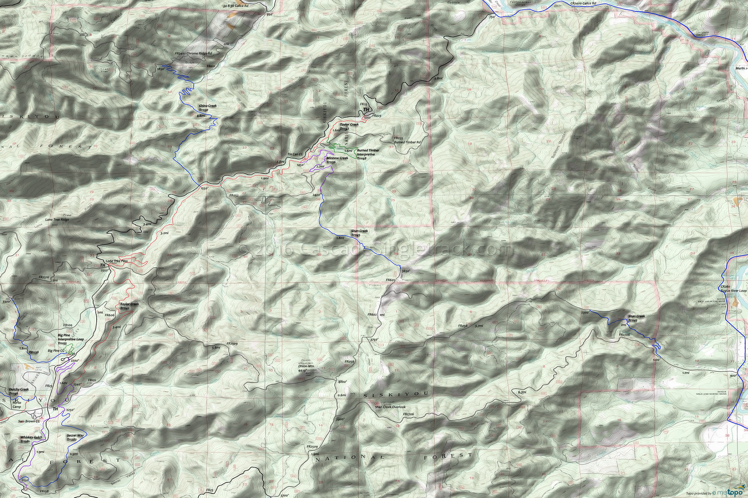
Taylor Creek Mountain Biking and Hiking Topo Map
Map includes: Burned Timber Interpretive Trail 1148, China Creek Trail 1130, Minnow Creek Trail 1156, Onion Way Trail 1157, Secret Way Trail 1282, Shan Creek Trail 1145, Taylor Creek Trail 1142, Whiskey Gulch Trail 1281 Mountain Bike and Hiking Trails.
TH: Ascend FR25 to Lone Tree Pass.
6.7mi: Go onto Taylor Creek Tr1142 (jedi section) and descend Briggs Valley.
10.1mi: Go left onto the connector, to Big Pine CG. Option: descend Onion Way Tr1157 to Whiskey Gulch Tr1281, returning on Secret Way Tr1282 or FR25.
11.7mi: Ascend FR25 to Lone Tree Pass.
13.6mi: Descend Taylor Creek Tr1142 switchbacks, resolving to a hillside descent back to the TH alongside Taylor Creek.
Draggable map: Map window adjusts to screen size and will respond to touch control. Use scrollbar for mouse control.
No Map? Browser settings and some browser extensions can prevent the maps from appearing. Please see Site Tech


