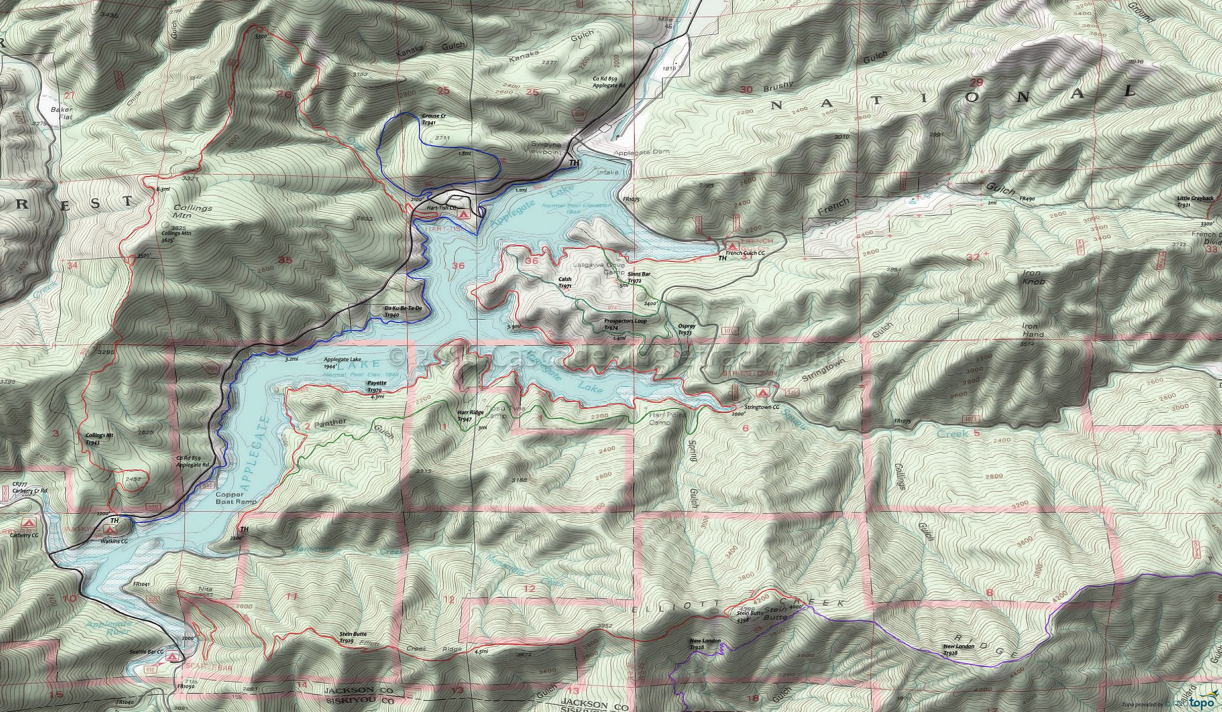
Applegate Lake Mountain Biking and Hiking Topo Map
Map includes: Da-Ku-Be-Te-De, Payette, Collings Mountain, Stein Butte, Grouse Point, Sinns Bar Trail, Calsh Trail, Prospectors Loop Trail, Osprey Trail, Harr Ridge Trail Mountain Bike and Hiking Trails.
TH: From the Swayne Viewpoint TH, ride Da-Ku-Be-Te-De Tr940 along the shoreline, crossing Grouse Creek at 1mi and joining County Road 859 at 4.2mi to cross the Carberry Creek inlet.
4.6mi: After crossing the bridge, go left onto County Road 777, crossing the Elliot Creek inlet bridge. Go left at the intersection with FR1041, near the Seattle Bar campground at the south end of Applegate Lake. Pass the Stein Butte Tr929 TH at 5.8mi.
6.7mi: The last .5mi of the FR1041 section climbs 450' up the Manzanita Creek drainage
7.4mi: Go left onto Payette Tr970 at the sharp right hand FR1041 curve. Pass a trail intersection near Panther Gulch (7.9mi), one of several lakeside trail options.
10mi: After several creek crossings, pass the Tipsu Tyee campground, followed by the Harr Point campground at 11.3mi.
11.6mi: Trail merges with FR100 for .4mi, near the Stringtown campground, then resumes the shoreline path with several intersections leading to interconnected hillside trails.
15mi: Pass the Latgawa Cove campground, then go left at the FR1075 intersection, near the French Gulch campground, crossing the Applegate Dam to return to the TH.
Draggable map: Map window adjusts to screen size and will respond to touch control. Use scrollbar for mouse control.
No Map? Browser settings and some browser extensions can prevent the maps from appearing. Please see Site Tech


