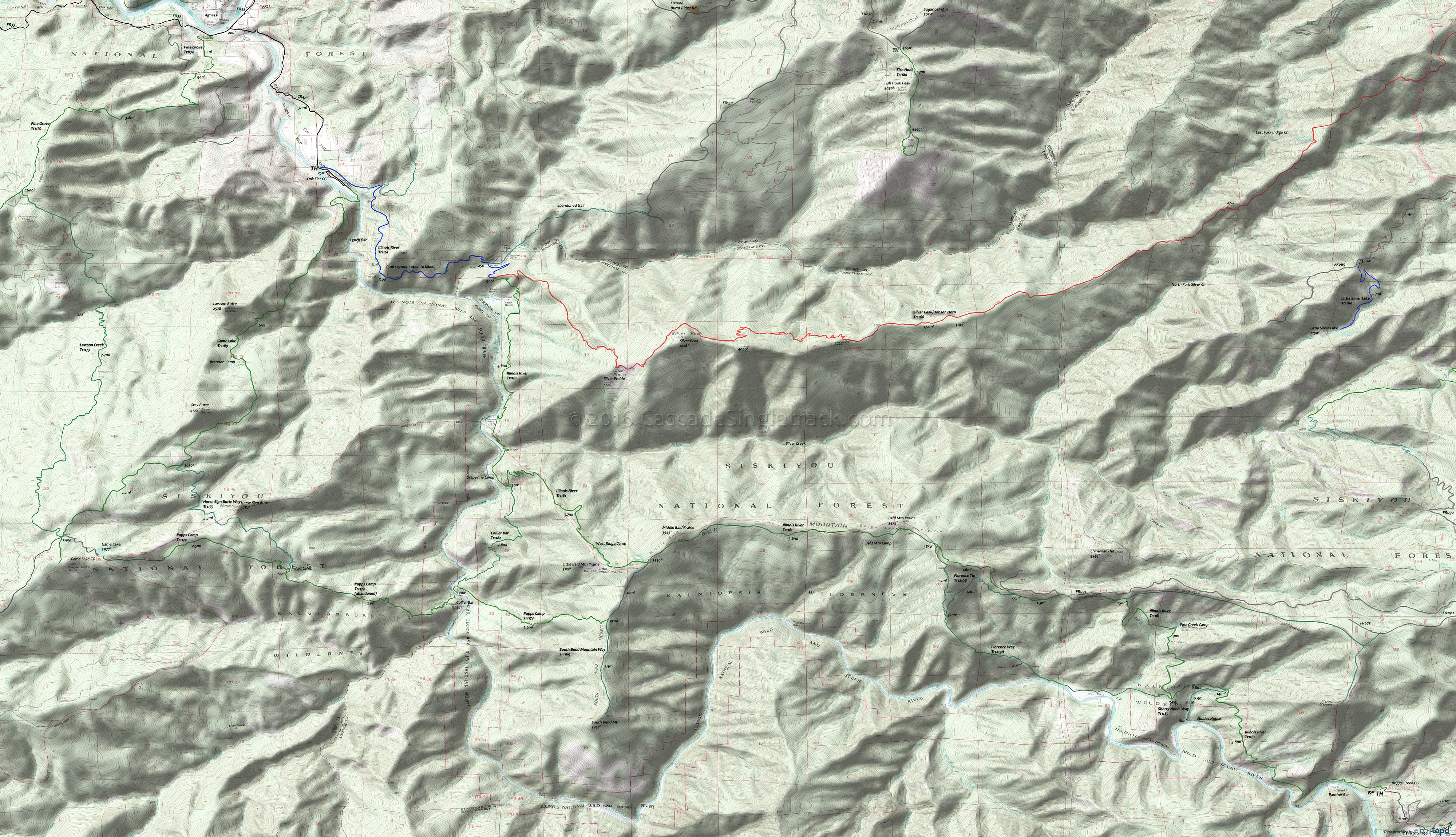
Illinois River Tr1161 Mountain Biking and Hiking Topo Map
Map includes: Collier Bar, Illinois River, Florence Way, Game Lake, Horse Sign Butte Way, Lawson Creek, Pine Grove, Pupps Camp, Shorty Noble Way, South Bend Mountain Way Hiking Trails.
This Kalmiopsis Wilderness trail offers of the best hikes in the Siskiyou National Forest. Wildflowers, old-growth trees, rugged and steep river canyons and a wide variety of wildlife, accessible nearly year-round across relatively low elevations from either TH. Bald Mountain will be snowed in, restricting full access to Spring-Fall.
A new bridge was built in 2005 across Silver Creek to replace one destroyed in the Biscuit Fire.
Game Lake Tr1169, Lawson Creek Tr1173 and Pine Grove Tr1170 form a loop from Agness to Game Lake.
Illinois River Trail East Access: From Grants Pass, go south on SR199 (Redwood Highway) 18mi to Selma. Go right at the Post Office (yellow flashing light) onto CR5070 (Illinois River Road) which becomes FR4103. The road is gravel/dirt, often with pot holes. The last few miles are narrower and rugged, and high-clearance vehicles are suggested. There are some junctions to private property in the Oak Flat area. At the junction with FR4105, stay to the left to remain on FR4103.
Mosquitoes are ferocious in this area until August. Feel free to try the natural repellents, and avoid drinking carbonated drinks prior to riding, but Deet 100 may be the only protection from 'the swarm'. Expect some trailside poison oak and prepare as needed. Try using Tecnu before the trip.
Draggable map: Map window adjusts to screen size and will respond to touch control. Use scrollbar for mouse control.
No Map? Browser settings and some browser extensions can prevent the maps from appearing. Please see Site Tech


