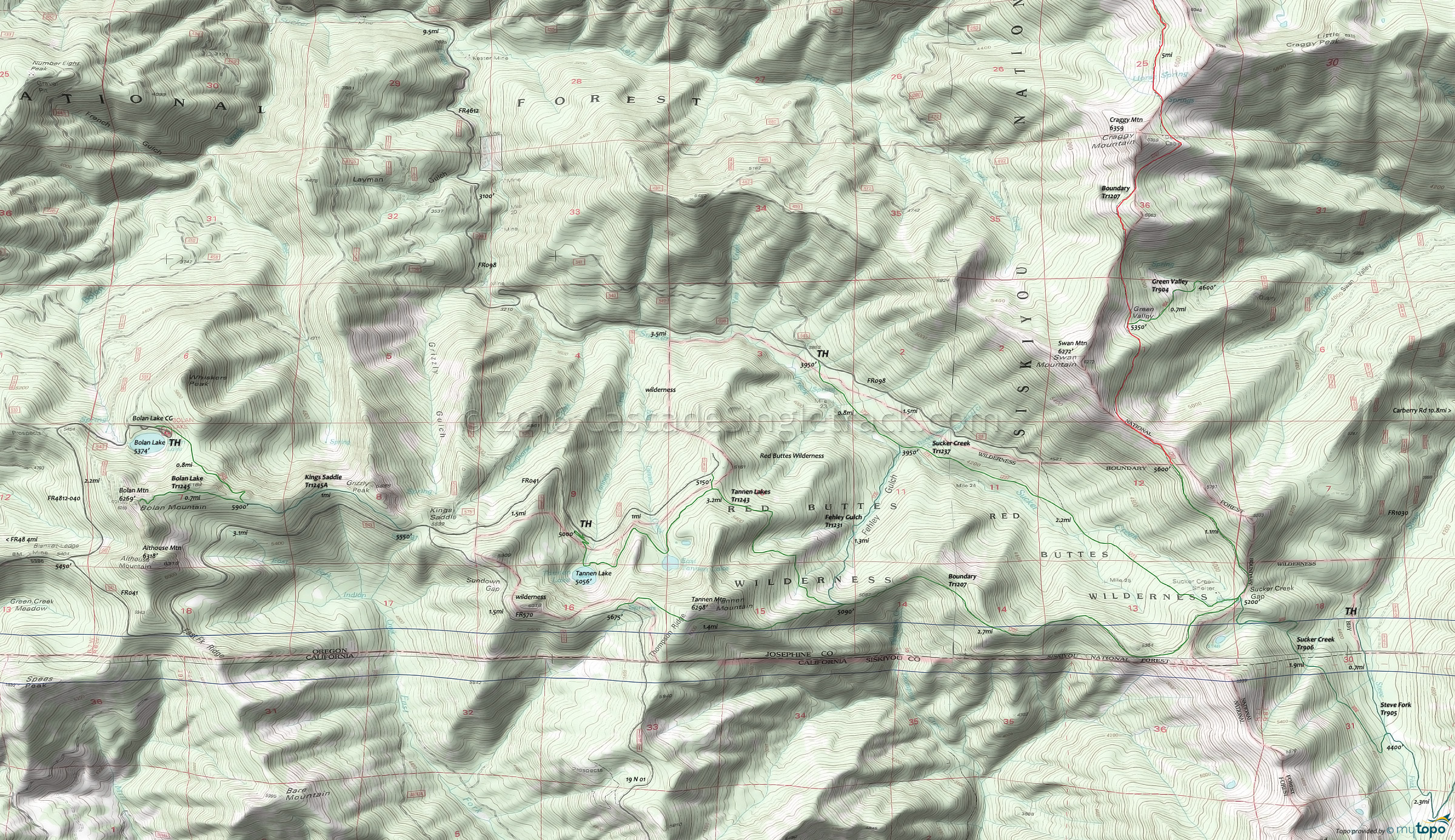
Red Buttes Wilderness Hiking Topo Map
Map includes: Bolan Lake Trail 1245, Boundary Trail 1207, Fehley Gulch Trail 1231, Green Valley Trail 904, Kings Saddle Trail 1245A, Steve's Fork Trail 905, Sucker Creek Trail 1237, Tannen Lakes Trail 1243 Hiking Trails.
Draggable map: Map window adjusts to screen size and will respond to touch control. Use scrollbar for mouse control.
No Map? Browser settings and some browser extensions can prevent the maps from appearing. Please see Site Tech


