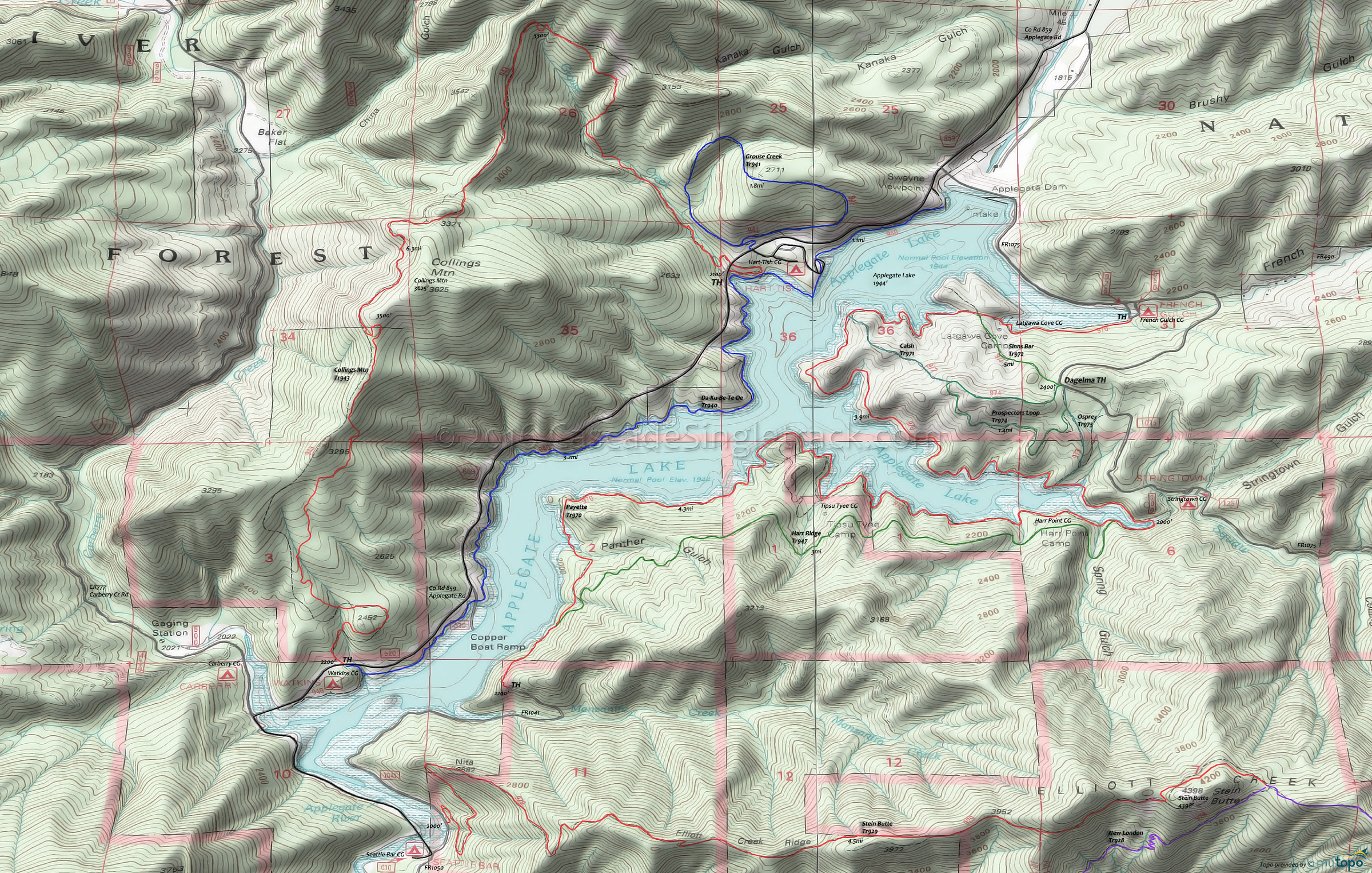
Collings Mountain Biking and Hiking Topo Map
Map includes: Da-Ku-Be-Te-De, Payette, Collings Mountain, Grouse Point Mountain Bike and Hiking Trails.
TH: From the Watkins campground trailhead, the 2.2mi, 1500' ascent is unrelenting, so grind it out.
2.2mi: Reach the Collings Mountain ridgeline and summit, then a 1mi switchback descent, climb then descent to Grouse Creek at 4.5mi.
4.6mi: 1.4mi steep descent through the Grouse Creek drainage, to County Rd 859, then return to TH on Da-Ku-Be-Te-De Tr940.
Draggable map: Map window adjusts to screen size and will respond to touch control. Use scrollbar for mouse control.
No Map? Browser settings and some browser extensions can prevent the maps from appearing. Please see Site Tech


