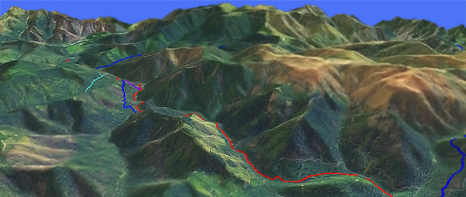
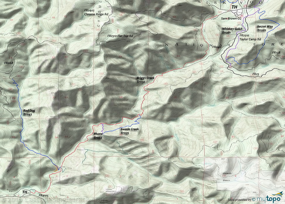
Briggs Creek Tr1132

Overall: 6
Aerobic: 6
Technical: 5
Steepness: 5
Flow: 5
Singletrack: 100%
Briggs Creek Tr1132 follows the creek drainage most of the distance to the Illinois River.
Type
OAB
Length
Avg: 16mi
Ascent
Moderate
Elevation Change
TH:2100'
Avg Ascent:3500'
Ascent Incline
7%
Duration
Avg: 3.5hr
Weather
Forecast
NOAA
popup
USFS
Tweets
Note: this area has experienced many wildfires over the past decade. Please check trail conditions with the Forest Service, to ensure the trail has received maintenance in the current year.
Contact Rogue Valley MTB Assn if interested in helping with trail maintenance or for trail information.
Briggs Creek Tr1132 ends at Soldier Creek near FR152, and connects to Red Dog Tr1143.
The trail was named for George E. Briggs, a packer who supplied early miners in the area. The Courier Mine Historic Cabin Site is located near the Swede Creek Tr1135 intersection, with numerous other mines along the way.
Ride includes several Briggs Creek crossings, so avoid this ride in the Spring or after a heavy rain. The repeated creek crossings add some technical challenge to the ride.
Directions: NW Forest Pass required right at the TH. I-5 Merlin exit 61 to Merlin Galice Rd, then go left on FR25 (Taylor Creek Rd) to FR2512, to the Sam Brown Campground TH. View Larger Map. No Map?.

OAB Directions
down and out
- TH: Ride from the Sam Brown CG on FR637, crossing the creek to begin the hillside traverse.
- 2.3mi: Briefly join FR040, then exiting the 4WD road at the corner, followed by a creek crossing to the east bank at 2.7mi.
- 4.2mi: Pass the Courier Mine Historic Cabin Site and Swede Creek Tr1135 intersection prior to crossing the creek to the west bank.
- 5.2mi: Cross the creek to the east bank, then pass the Phone Tr1153 intersection, followed by a Swede Creek crossing at 5.8mi.
- 6.7mi: Pass the Red Dog Tr1143 intersection, and several side paths to abandoned mine sites.
- 7.9mi: Reach the FR4105 TH, then return to the upper TH.
Trail Index
This Ride
Briggs Creek Trail 1132
Area
China Creek Trail 1130, Dutchy Creek Trail 1146, Hobson Horn Trail 1166, Little Silver Lake Trail 1184, Phone Trail 1153, Red Dog Trail 1143, Swede Creek Trail 1135, Minnow Creek Trail 1156, Onion Way Trail 1157, Secret Way Trail 1282, Shan Creek Trail 1145, Taylor Creek Trail 1142, Whiskey Gulch Trail 1281
Hiking
Big Pine Interpretive Loop Trail 1155, Burned Timber Interpretive Trail 1148, Illinois River Trail 1161
Campgrounds
Big Pine Campground, Briggs Creek Campground, Sam Brown Campground
Trail Rankings
Ranking consistently applied to all of the listed trails.
- Overall Rating: Ride quality and challenge
- Aerobic: Ascent challenge
- Technical Difficulty: Terrain challenge
- Steepness: Average incline
- Flow: Uninterrupted riding
- Elevation Change: Total elevation gain
- Ride Difficulty: Terrain challenge


