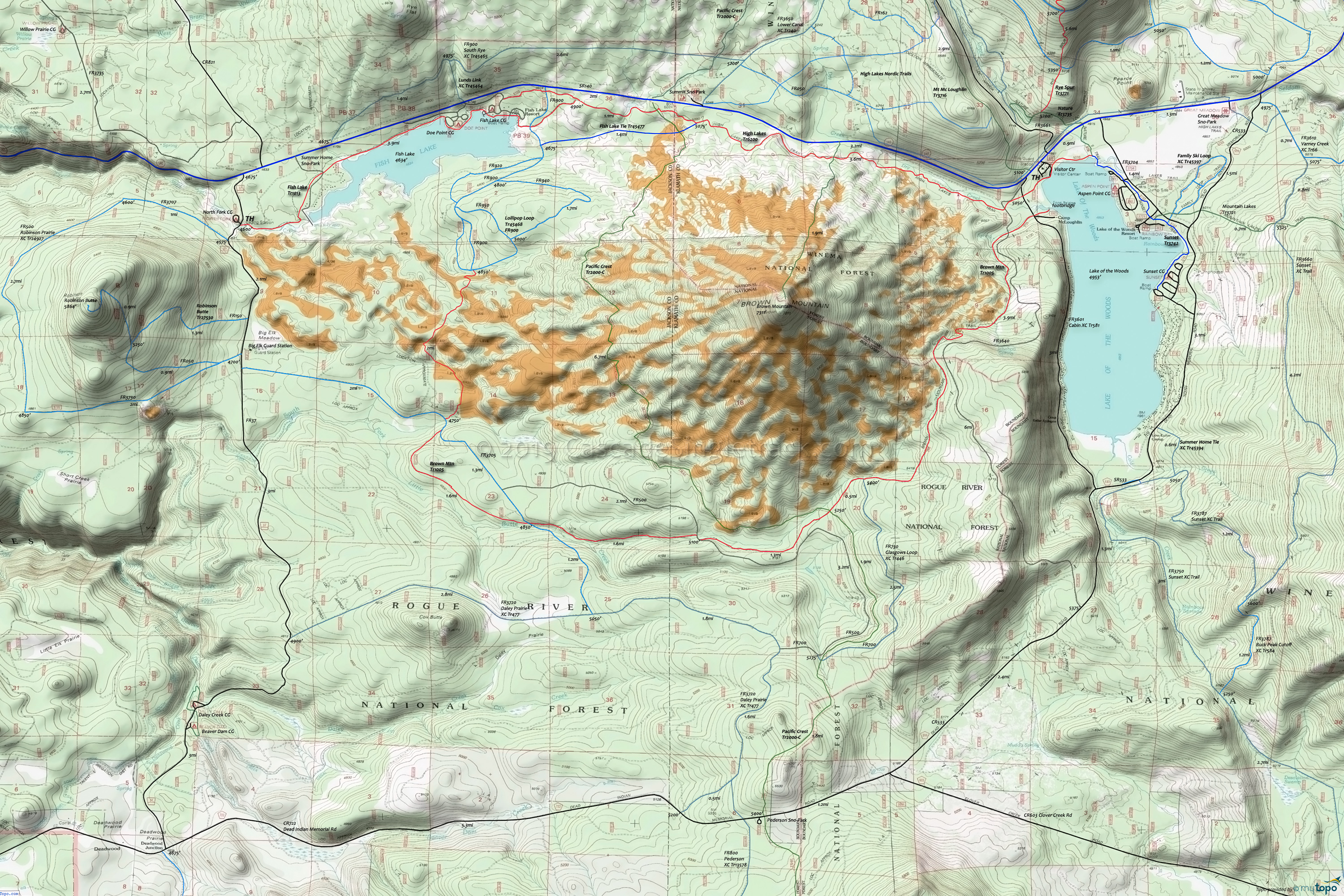
Brown Mountain Trail 1005 Area Mountain Biking and Hiking Topo Map
Map includes: Brown Mountain Trail 1005, Fish Lake Trail 1013, Fish Lake Tie Trail 45477, High Lakes Trail 6200, Lollipop Loop Trail 45468, Pacific Crest Tr2000-C, Robinson Butte Trail 27530 Mountain Biking and Hiking Trails.
TH: From the Visitors Center, ride High Lakes Tr6200 to FR3601 or FR3640, then go left to Brown Mt Tr1005 and begin ascent.
2.8mi: The forest boundary marks the end of the 700' climb, at 5656'
5mi: Cross the Pacific Crest Trail, having more fun than any of those hikers.
6.4mi: The trail follows the South Fork of Little Butte Creek then crosses it, using FR500.
9.1mi: Trail merges with FR375 for .5mi. Go to the right onto FR350 at the fork, then go through 2mi of lava flow trail.
11.8mi: Trail ends at FR900. Take this doubletrack 2mi to Fish Lake Tr1013, just past Fish Lk Tie Tr45477.
13.8mi: Go right onto Fish Lake Tr1013, to High Lakes Tr6200. Ride back to the TH.
Draggable map: Map window adjusts to screen size and will respond to touch control. Use scrollbar for mouse control.
No Map? Browser settings and some browser extensions can prevent the maps from appearing. Please see Site Tech


