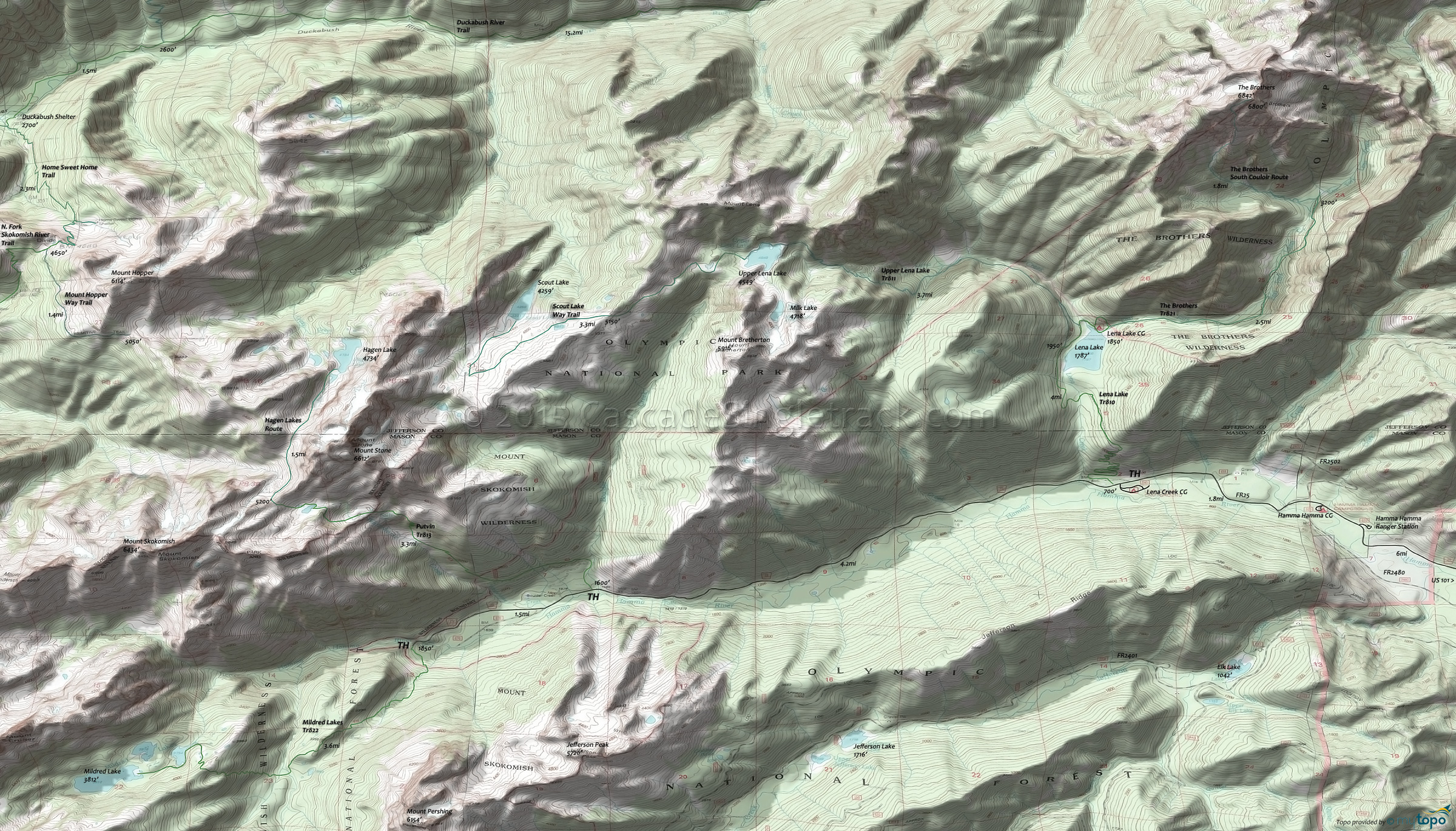
The Brothers Trail 821 and Upper Lena Lake Trail 811 Area Hiking Topo Map
Map includes: Duckabush River Trail, Hagen Lakes Route, Home Sweet Home Trail, Mildred Lakes Trail 822, Mount Hopper Way Trail, Putvin Trail 813, Scout Lake Way Trail, The Brothers Trail 821, The Brothers South Couloir Route, Upper Lena Lake Trail 811 Hiking Trails.
The Brothers Tr821 passes through a remote canyon area called the Valley of the Silent Men. The Brothers South Couloir Route is a climbing route, requiring advanced climbing skills.
Putvin Tr813 is a high summer hike, starting alongside the Hamma Hamma River in the Boulder Creek Valley, then ascending the steep slopes of Mount Stone, alongside Whitehorse Creek, before reaching an avalanche area, with views of Mount Pershing and Copper Mountain. There are several headwalls to climb, limiting the upper section to advanced climbers. The trail wanders through subalpine forest meadows past the Lake of the False Prophets, then crosses Whitehorse creek.
The easy access, 4mi Lena Lake Tr810 provides access to the Lena Lake CG, so is quite busy in the summer. The hike is relatively flat after the initial 1.4mi, 1400' ascent. The 3.7mi (3100' ascent) Upper Lena Lake Tr811 continues a gradual West Fork Lena Creek Valley ascent for 1.5mi, then ascends steeply to the upper lake.
Draggable map: Map window adjusts to screen size and will respond to touch control. Use scrollbar for mouse control.
No Map? Browser settings and some browser extensions can prevent the maps from appearing. Please see Site Tech


