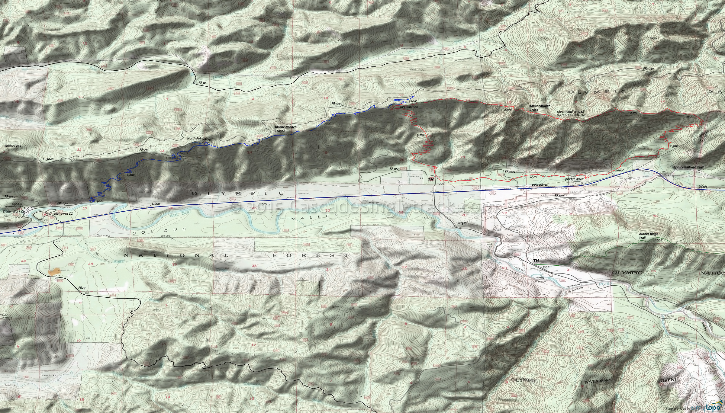
Kloshe Nanitch Trail 882.1 and Mount Muller Trail 882 Area Mountain Biking and Hiking Topo Map
TH: From the FR3071 TH, cross Littleton Creek and continue to ascend or hike-a-bike through the switchbacks to Jim's Junction. Go left (of the visitors register) and uphill out of the parking area.
3.1mi: At Jim's junction, either go OAB on Kloshe Nanitch Tr882.1 or continue on to Mount Muller Summit, passing through Millsap, Jasmine, Allison and Markham Meadows.
5.3mi: Pass the Mount Muller ride summit, followed by a 1.5mi switchback descent towards Cahill Overlook, passing Molly's Meadow and Panorama Point.
8.6mi: The steep switchbacks begin at the 7.3mi Cahill Overlook, descending steeply to a private drive roadcrossing at 9.9mi. Pass the cave-like rock formation called Fouts Rock House at 8.5mi.
10mi: Cross Hutch Creek then return to the TH, paralleling U.S. 101.
Draggable map: Map window adjusts to screen size and will respond to touch control. Use scrollbar for mouse control.
No Map? Browser settings and some browser extensions can prevent the maps from appearing. Please see Site Tech


