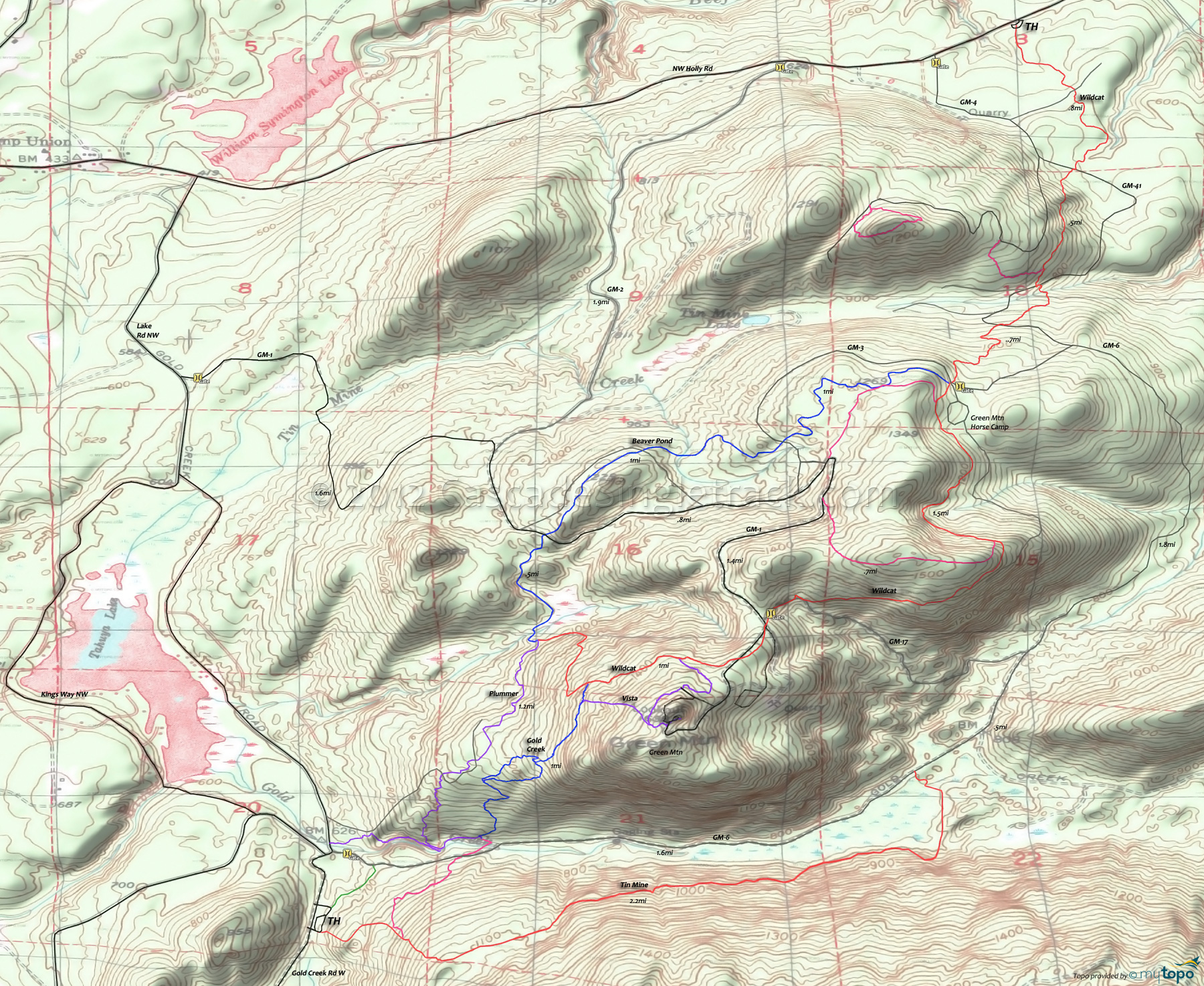
Green Mountain: Gold Creek Trail Area Mountain Biking and Hiking Topo Map
Map includes: Beaver Pond Trail, Gold Creek Trail, Plummer Trail, Tin Mine Trail, Vista Trail, Wildcat Trail Mountain Biking and Hiking Trails.
TH: Ride .5mi from either the Gold Creek TH parking lot or the singletrack which parallels GM-6 (uphill of the creek), to the 5-way Gold Creek intersection and work the steep ascent to the loop intersection.
1mi: Go right, to take the downhill side of the loop, then bear right at the end of the loop and complete the ascent to Wildcat.
1.6mi: Go left on Wildcat and descend to the Beaver Pond-Plummer intersection, then bear right and ascend around the beaver ponds, crossing a wooden bridge then GM-1 at 2.5mi. Cross a GM-1 spur at 2.9mi and GM-3 at 3.4mi, then continue to bear left at the 3.9mi side trail T intersections.
4.1mi: Go right onto the occasionally technical Wildcat, passing a side trail at 4.9mi. After passing a clearcut, Wildcat briefly merges with GM-17 at 5.6mi then crosses GM-1 several times before reaching the Vista intersection.
6mi: Go left onto Vista and ascend the steep slope to the Green Mountain ride summit. Descend the side trail to Gold Creek at 6.7mi and go left, returning to the TH.
Option: Continue on Wildcat and descend the sometimes wild Plummer trail.
Draggable map: Map window adjusts to screen size and will respond to touch control. Use scrollbar for mouse control.
No Map? Browser settings and some browser extensions can prevent the maps from appearing. Please see Site Tech


