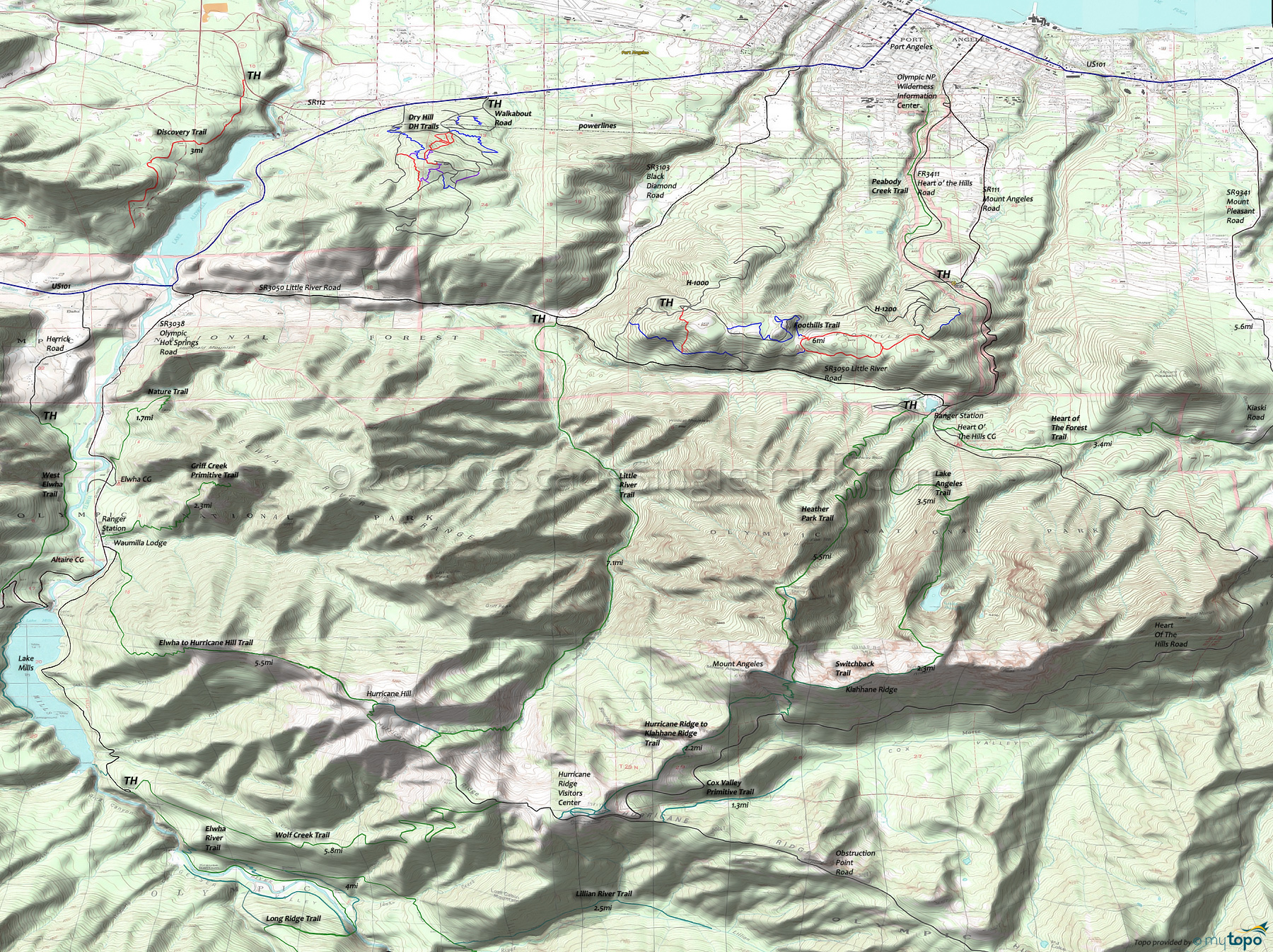
Foothills Singletrack Trail and Lake Angeles Trail Area Mountain Biking and Hiking Topo Map
Map includes: Dry Hill Trails, Foothills Singletrack Trail, Heather Park Trail, Lake Angeles Trail, Lillian River Trail, Little River Trail Mountain Biking and Hiking Trails.
Shown on the Area Map, the 5.5mi (5100' ascent) Heather Park Trail ascends the northern slopes of Mount Angeles, and can be combined with 6mi of Lake Angeles and Switchback trails to form a very challening loop. An ice ax may be needed to hike Lake Angeles during the spring and early summer.
From Kiaski Rd, the 3.4mi (1200' ascent) Heart of the Hills trails is a far more intermediate hike, for those not seeking high elevation wilderness climbing.
TH: From the upper H-1000 parking area, create a figure eight loop of the single and doubletrack. Ascend from the parking area, with singletrack breaking from the jeep road, then returning to follow alongside the road again.
2.4mi: After reentering the woods, reach the loop and bear left. Ride the loop, passing the eastern spur at 3.2mi, with an option to explore 1mi further to the east, then return.
4mi: Bear left onto singletrack that merges with an abandoned road. Continue on the road to the curve, then take the singletrack.
5.2mi: Either climb the steep section back to the TH, or continue on to H-1000, then climb the road back to the TH...or do another lap.
Draggable map: Map window adjusts to screen size and will respond to touch control. Use scrollbar for mouse control.
No Map? Browser settings and some browser extensions can prevent the maps from appearing. Please see Site Tech


