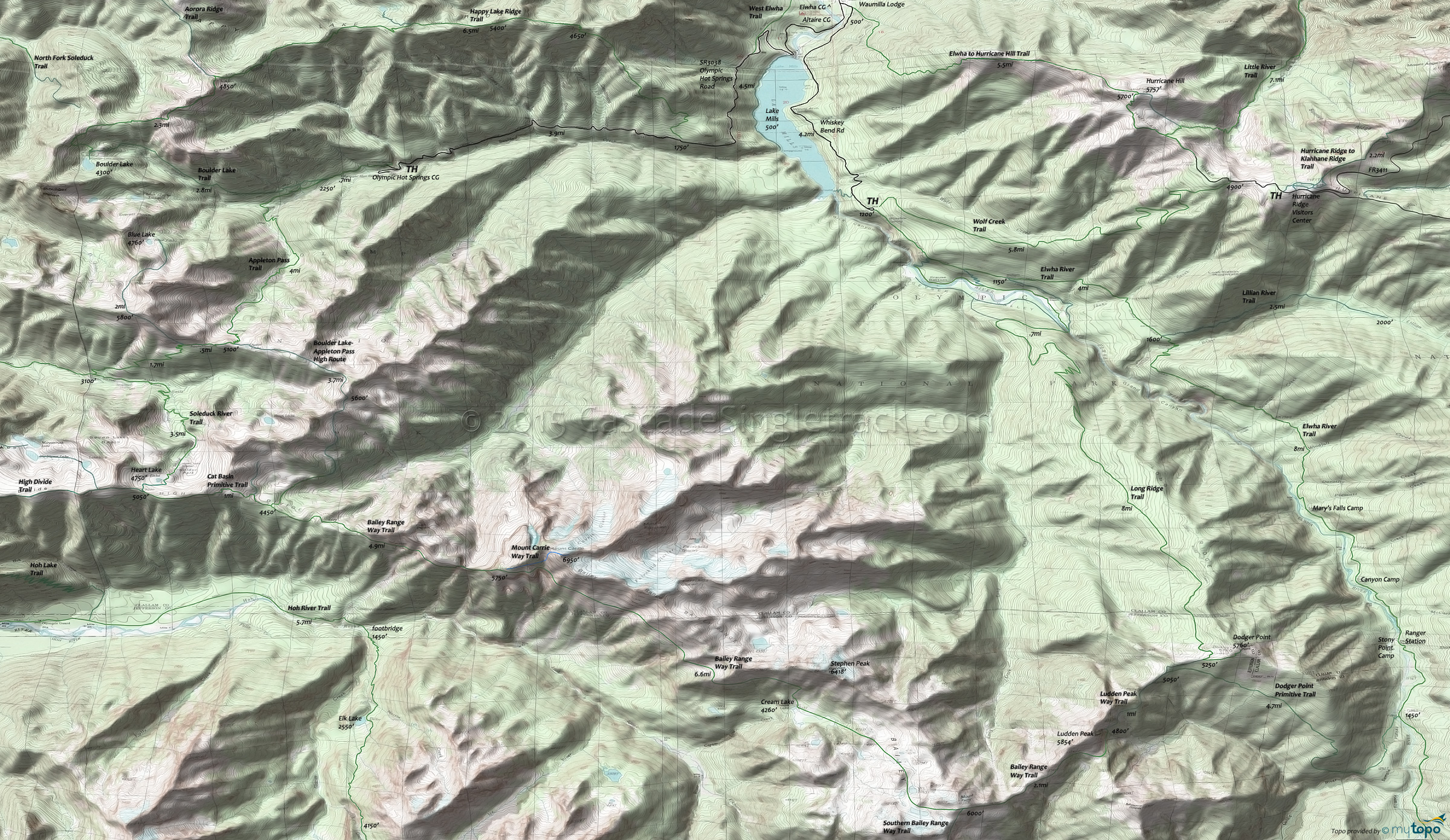
Bailey Range Way Trail and Wolf Creek Trail Area Hiking Topo Map
Map includes: Appleton Pass Trail, Bailey Range Way Trail, Boulder Lake Trail, Cat Basin Primitive Trail, Dodger Point Primitive Trail, Elwha River Trail, Elwha to Hurricane Hill Trail, Happy Lake Ridge Trail, Lilian River Trail, Long Ridge Trail, Ludden Peak Way Trail, Mount Carrie Way Trail and Wolf Creek Trail.
The 7mi (4500' ascent) Little River Trail is another day-hike option requiring intermediate skills and stamina, and could even be shuttled from Hurricane Ridge Rd.
Hurricane Ridge is often accessed from Lake Mills, using the Wolf Creek trail and the Elwha-to-Hurricane trail.
From the Whiskey Bend TH, the Elwha River trail passes through lowland forest and valleys, passing Lillian River Camp, Mary's Falls Camp, Canyon Camp, Elkhorn, Hayes River Guard Station, Camp Wilder and Chicago Camp along the way.
The Chicago Camp, river crossing limits access to the Low Divide upper reaches, but that leaves the the lower 23mi of trail to explore. Expect plenty of fellow hikers, as this is a very popular hike.
Elwha to Hurricane Hill Trail and Wolf Creek Trail combine to form a challening 16mi (7000' ascent) CCW loop day hike, which includes 4mi of hiking along the Whiskey Bend Road.
The Long Ridge Trail, Bailey Range Way and Appleton Pass trails can be combined into an epic 31mi (13500' ascent) loop, far beyond a typical day hike.
Needless to say, the Mount Olympus climbing routes should only be attempted by experienced mountaineers who have glacier travel and crevasse rescue skills and gear. Camp areas are located at Caltech Rocks and Snow Dome, with no camping between Glacier Meadows and Blue Glacier.
Draggable map: Map window adjusts to screen size and will respond to touch control. Use scrollbar for mouse control.
No Map? Browser settings and some browser extensions can prevent the maps from appearing. Please see Site Tech


