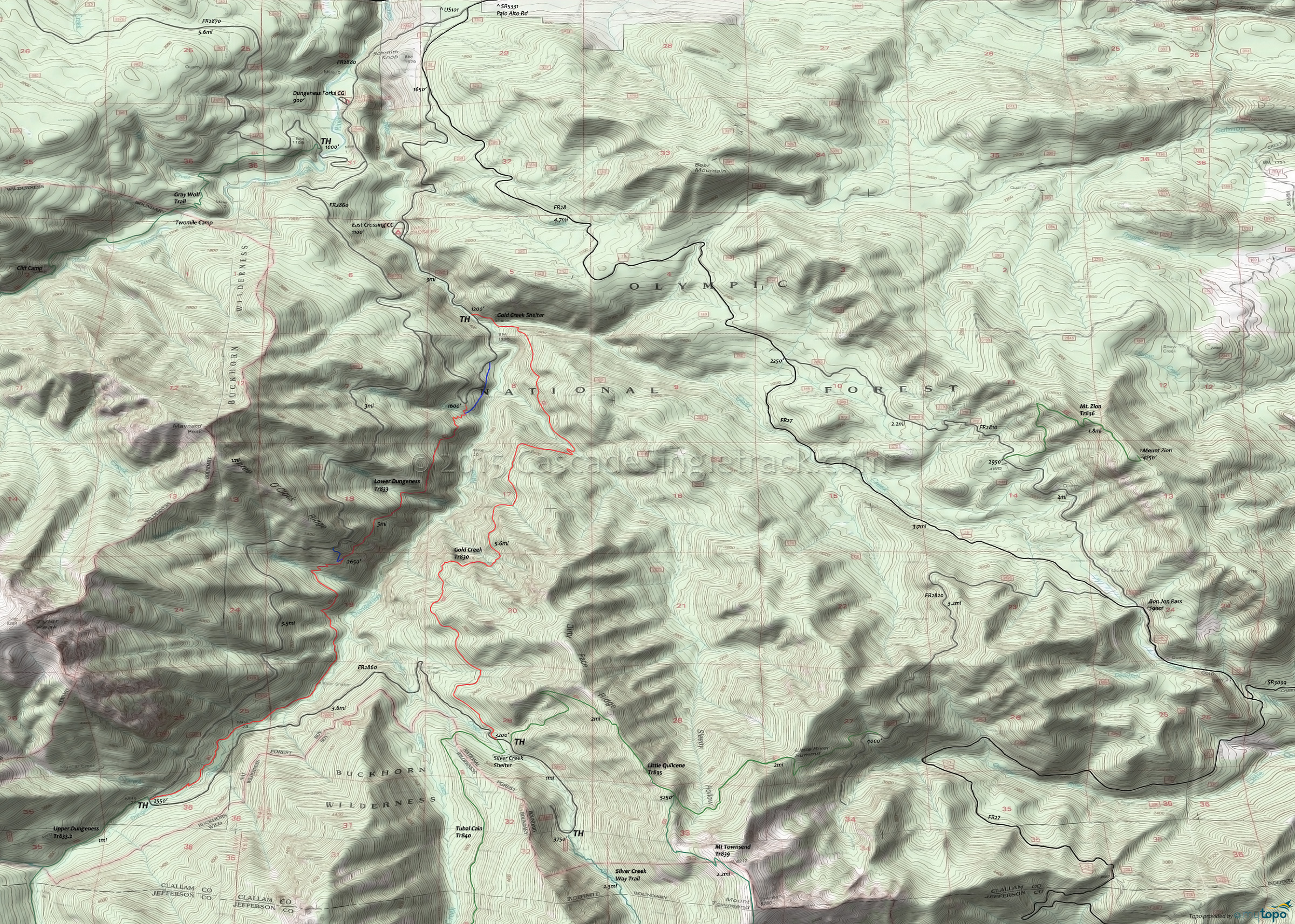
Gold Creek Trail 830 and Lower Dungeness Trail 833 Area Mountain Biking and Hiking Topo Map
Map includes: Gold Creek Trail 830, Little Quilcene Trail 835, Lower Dungeness Trail 833, Mount Townsend Trail 839, Mount Zion Trail 836, Silver Creek Way Trail, Tubal Cain Trail 840.
TH: From the Gold Creek Tr830 TH, ascend 1mi to Lower Dungeness Tr833 TH, with the option at .5mi of ascending the spur trail to Lower Dungeness Tr833.
1mi: Go left onto Lower Dungeness Tr833. Cross Skookum Creek and Cougar Creek, pass the Three O'Clock Ridge Trail FR2860 connector at 2.7mi, followed by a descent to Dungeness Creek. The ascent includes some cliff exposure and steep ascents, which may result in some hike-a-bike for intermediate riders. Cross Bungalow Creek and several smaller creeks prior to reaching Dungeness Creek. Pass the River Shelter at 4.4mi, then gradually ascend to FR2860.
6mi: Cross Mueller Creek, pass the Upper Dungeness (hiking) Tr833 intersection, then go left onto FR2860. After a brief descent, gradually climb alongside Silver Creek to Gold Creek Tr830. The TH is on the left, just prior to the Tubal Cain Tr840 TH (on the right).
9.7mi: Go left onto Gold Creek Tr830, crossing a creek and some flat terrain before a brief climb to the ride summit at 10.9mi. At 12.3mi, the Dirty Face Ridge descent gets much more serious, with a steep descent to Gold Creek. Go left at the 13.3mi fork, navigate some switchbacks to a creek crossing, then rip through the final plunge to Gold Creek at 15mi.
Draggable map: Map window adjusts to screen size and will respond to touch control. Use scrollbar for mouse control.
No Map? Browser settings and some browser extensions can prevent the maps from appearing. Please see Site Tech


