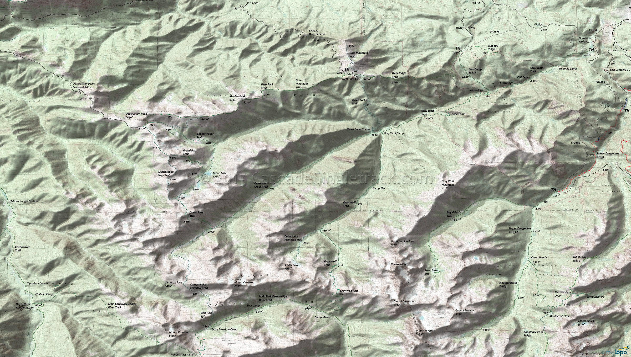
Gray Wolf Trail 834 and Slab Camp Trail 838 Area Hiking Topo Map
Map includes: Badger Valley Trail, Blue Mountain Trail, Cameron Creek Trail, Cameron Pass Primitive Trail, Cedar Lake Primitive Trail, Deer Ridge Trail 846, Grand Pass Trail, Gray Wolf Trail 834, Lilian Ridge Way Trail, Main Fork Dosewallips Trail, Royal Basin Trail, Slab Camp Trail 838, Three Forks Trail, Upper Dungeness Trail.
To the west of Lower Dungeness Tr833 are 30mi of hiking trails between Gray Wolf River and Deer Ridge, accessible from the Slab Camp TH and Deer Park Rd.
Deer Ridge Trail 846 ascends from the FR2875 Slab Camp TH to the Deer Park Campground, with a sometimes steep (35%) grade. The ridgeline hike continues within the park on Obstruction Point-Deer Park Trail, with Grand Pass or Badger Valley Trail as a connector to Cameron Creek Trail, returning on Gray Wolf Tr834 as a very challenging 36mi loop. Ice axes are recommended for traversing the slope at the top of the Badger Valley Way Trail.
The 18mi (8900' ascent to Gray Wolf Pass) Gray Wolf Tr834 is an easily accessible valley trail which passes through subalpine forest and meadows, with Graywolf, Three Forks, Camp Ellis and Falls Camp sites within the national park boundaries. The trail descends steeply an additional 3mi from Gray Wolf Pass Main Fork Dosewallips River Trail.
Draggable map: Map window adjusts to screen size and will respond to touch control. Use scrollbar for mouse control.
No Map? Browser settings and some browser extensions can prevent the maps from appearing. Please see Site Tech


