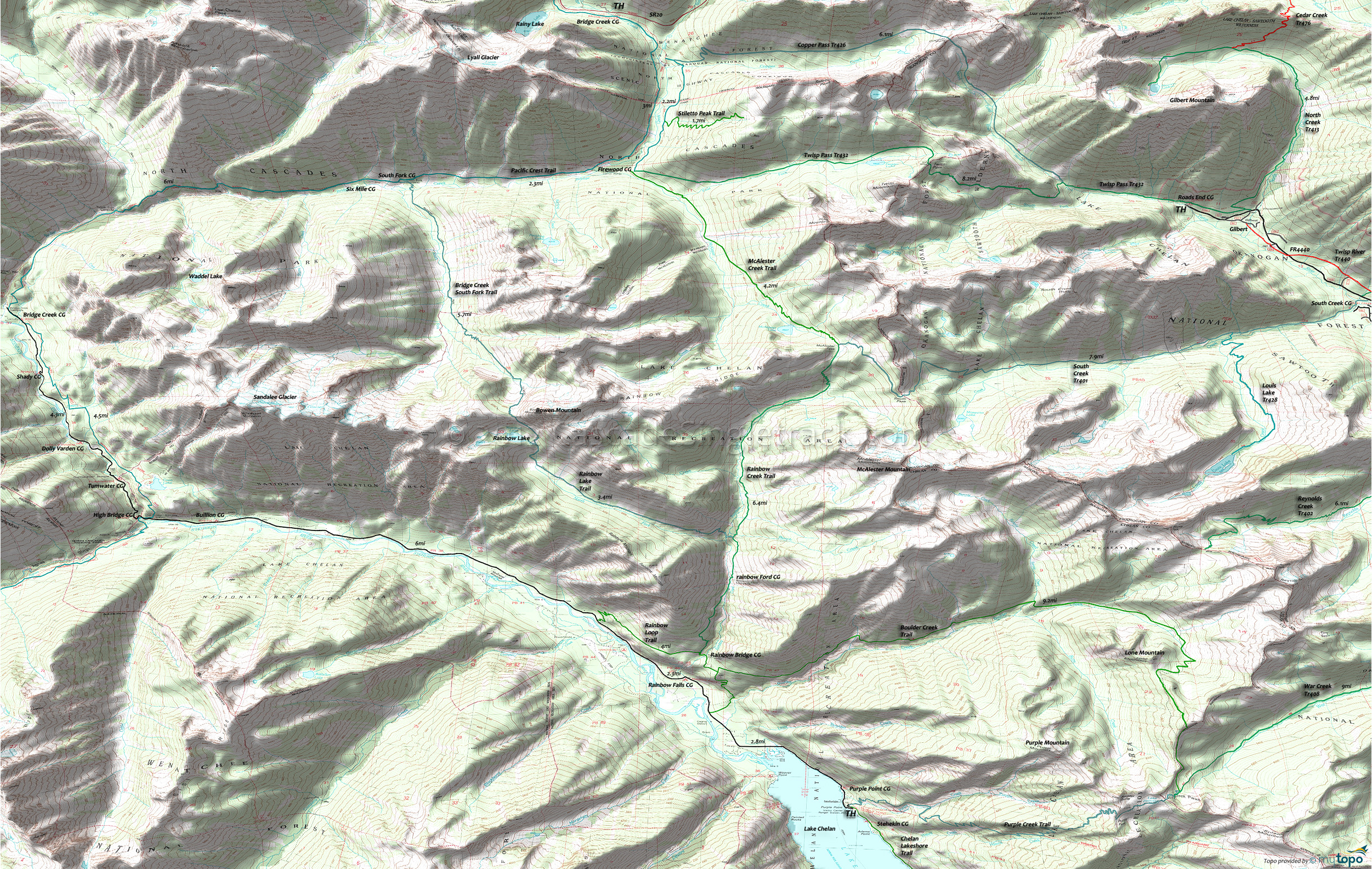
Copper Pass Trail and South Creek Trail Area Hiking Topo Map
Twitter Search
#PacificCrestTrail
Map includes: Copper Pass Trail 426, Louis Lake Trail 428, McAlester Creek Trail, North Creek Trail 413, Pacific Crest Trail 2000-L, South Creek Trail 401, Twisp Pass Trail 432 Hiking Trails.
Area Campgrounds: Bridge Creek Campground, Bullion Campground, Dolly Varden Campground, Firewood Campground, High Bridge Campground, Purple Point Campground, Rainbow Falls Campground, Roads End Campground, Shady Campground, Sixmile Campground, South Creek Campground, South Fork Campground, Stehikin Campground, Tumwater Campground.
North Creek Tr413 follows the creek, circumnavigating Gilbert Mountain, passing the (7000') Abernathy Pass Cedar Creek Tr476 intersection at 3.2mi, crossing avalanche paths (most notably at 1.7mi) and sub-alpine forest to North Lake. The route offers good views of Abernathy Ridge and the Sawtooth Range. The 2.1mi North Creek crossing is not bridged and is hazardous during Spring runoff.
Twisp Pass Tr432 has several stream crossings prior to the 2.2mi Copper Pass Tr426 intersection, then crosses 1mi of rocky terrain before passing through subalpine forest and a number of small meadows to Twisp Pass. The trail then continues in the North Cascades National Park, alongside East Fork McAlester Creek to the Firewood CG.
Copper Pass Tr426 follows the North Fork Twisp River to Copper Pass, then descends alongside Copper Creek to meet the Pacific Crest Trail at State Creek. This lightly used trail will require some pathfinding, so a GPS is suggested.
South Creek Tr401 (3400' ascent) includes a number of avalanche paths for the first 4.5mi, passing the Louis Lake Tr428 intersection at 2.1mi. There are half a dozen creek crossings on the increasingly rocky terrain as the trail crosses South Pass, then descends to Rainbow Creek Trail in the North Cascades National Park. The 5000' ascent Louis Lake Tr428 starts by descending to the trail bridge crossing of South Creek, but it is all uphill from there, switchbacking through old-growth Douglas fir, Engleman spruce, and Western White Pine forest, then continuing the ascent high above Louis Creek, through old avalanche paths and subalpine forest to the lake.
McAlester Creek Trail connects South Creek Tr401 to Twisp Pass Tr432, passing through mountain hemlock, subalpine fir, and subalpine larch forest.
Draggable map: Map window adjusts to screen size and will respond to touch control. Use scrollbar for mouse control.
No Map? Browser settings and some browser extensions can prevent the maps from appearing. Please see Site Tech


