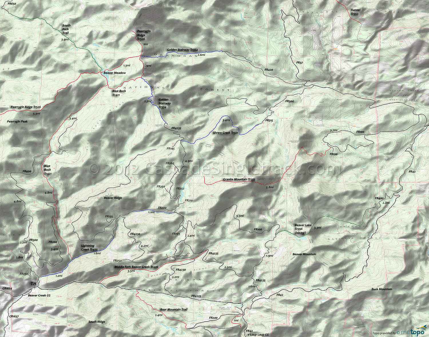
Lightning Creek Trail 425 Area Mountain Biking and Hiking Topo Map
Map includes: Bear Mountain Trail, Blue Buck Trail 421, Golden Stairway Trail 354, Granite Mountain Trail 355, Lightning Creek Trail 425, Middle Fork Beaver Creek Trail 406, Shrew Creek Trail 321, South Fork Trail Mountain Biking and Hiking Trails.
TH: From the Lightning Creek TH, Climb road FR4225 for 1.8mi.
2.2mi: Go left on Middle Fork Beaver Cr Tr406.
5.7mi: Go left at the 'T' onto FR4235, climbing to the Starvation Mountain summit.
10.4mi: Option: Go onto Lightning Creek Tr425 and return to the TH unless continuing to the summit.
13.1mi: Ride Golden Stairway Tr354 to Blue Buck Tr421. (If shuttling you could park here. If not...try not to think about it too much.)
15.6mi: At the ridge crest, go left onto Blue Buck Tr421. Trail is not well marked, although there might be a cairn at the TH.
16.8mi: South Fork Trail intersection. Go left at the fork to stay on the trail.
20.2mi: Cross the gravel pit and go right on FR400 then get back onto the trail.
25.4mi: Bear left to stay on the trail
25.1mi: Go left, then cross Beaver Cr, then bear left at the next fork. Turn right onto Lightning Creek Tr425, then cross Beaver Cr. again.
Draggable map: Map window adjusts to screen size and will respond to touch control. Use scrollbar for mouse control.
No Map? Browser settings and some browser extensions can prevent the maps from appearing. Please see Site Tech


