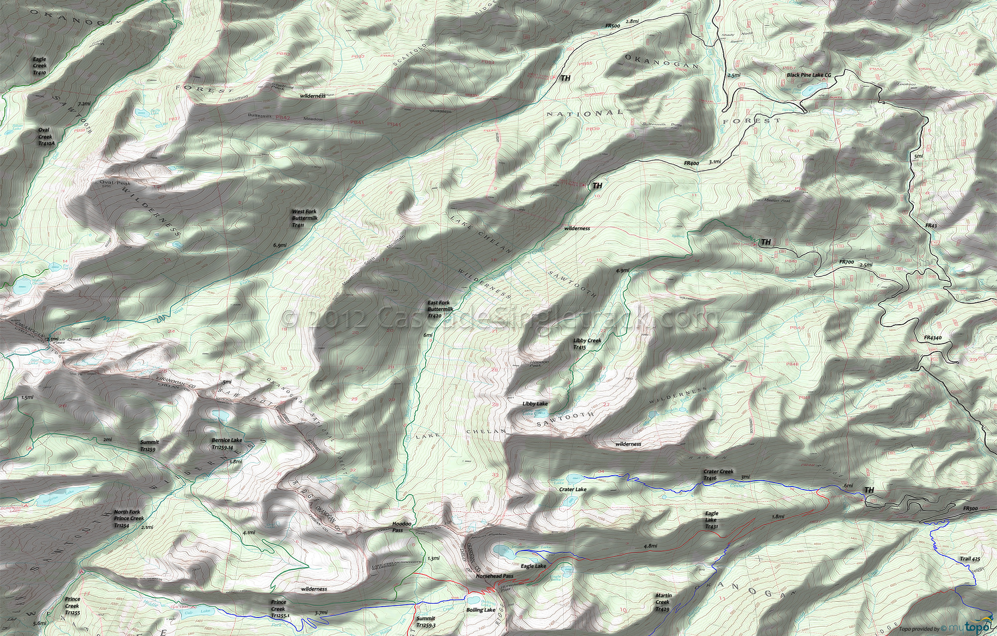
Prince Creek Trail 1255 and East Fork Buttermilk Trail 420 Area Hiking Topo Map
Map includes: Bernice Lake Trail 1259.14, East Fork Buttermilk Trail 420, Hoodoo Pass Trail 1259.31, Hoodoo Spur Trail 1255.12, Libby Creek Trail 415, North Fork Prince Creek Trail 1254, Prince Creek Trail 1255, Summit Trail 1259, West Fork Buttermilk Trail 411 Hiking Trails.
North of the Eagle Lake area, hikers can access East Fork Buttermilk Tr420 and Libby Creek Trail 415 in the Sawtooth Wilderness area, from FR43. Black Pine Lake CG is well positioned as a basecamp for exploring Sawtooth Wilderness terrain.
To the west, the Prince Creek campground is accessible by ferry, and offers a great CCW loop hiking trail with Summit Trail 1259, Fish Creek Trail 1248, Indianhead Basin Trail 1250 and Horton Butte Trail 1250.1, returning on Lakeshore Trail 1247.
Draggable map: Map window adjusts to screen size and will respond to touch control. Use scrollbar for mouse control.
No Map? Browser settings and some browser extensions can prevent the maps from appearing. Please see Site Tech


