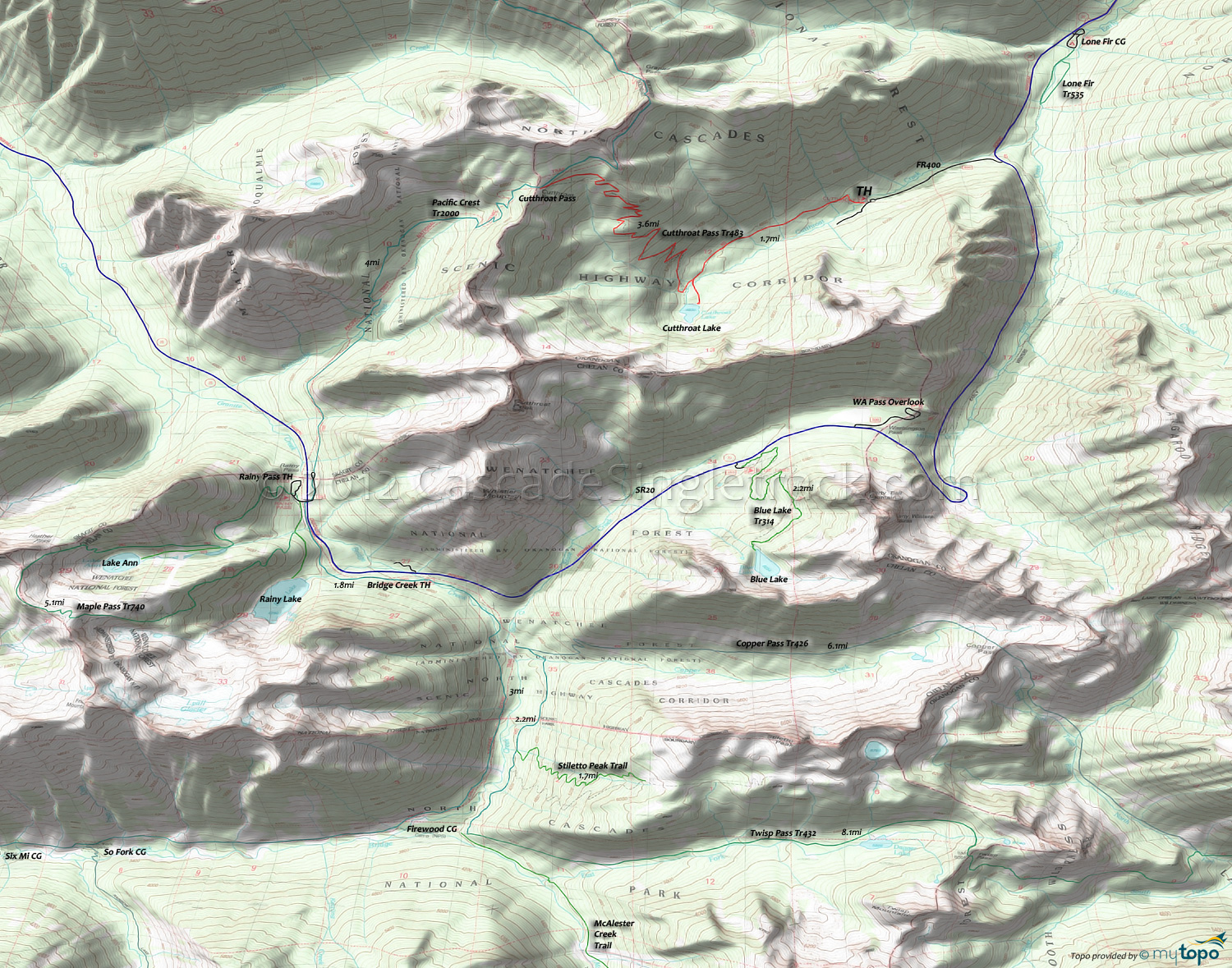
Cutthroat Pass Trail and Pacific Crest Trail Area Mountain Biking and Hiking Topo Map
Twitter Search
#PacificCrestTrail
Map includes: Blue Lake Trail 314, Copper Pass Trail 426, Cutthroat Pass Trail 483, Lake Ann Trail 740.1, Lone Fir Trail 535, Maple Pass Trail 740, Pacific Crest Trail 2000-L and Rainy Lake Trail 310 Mountain Biking and Hiking Trails.
TH: Cross Cutthroat Creek and ascend the easy but technical terrain to the 1.5mi Cutthroat Lake intersection. Venture out to the lake and back.
1.5mi: Cross Cutthroat Creek tributaries, then grind the relentless switchbacks to Cutthroat Pass.
5.7mi: Turn around at the Pacific Crest Tr2000 intersection and enjoy the technical switchback ride to the lake intersection and the easy terrain back to the TH.
Draggable map: Map window adjusts to screen size and will respond to touch control. Use scrollbar for mouse control.
No Map? Browser settings and some browser extensions can prevent the maps from appearing. Please see Site Tech


