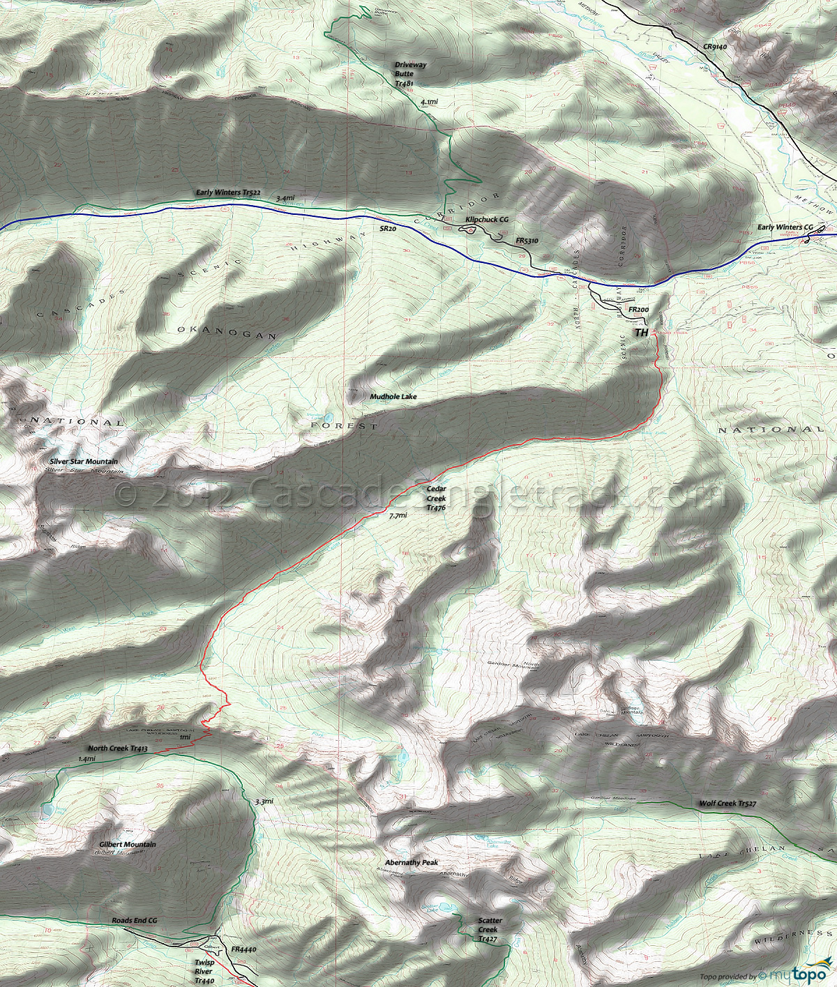
Cedar Creek Trail 476 Area Mountain Biking and Hiking Topo Map
Map includes: Cedar Creek Trail 476, Driveway Butte Trail 481, Early Winters Trail 522 and North Creek Trail 413 Mountain Biking and Hiking Trails.
TH: Traverse the hillside from the TH. Do not take 476A, which is an abandoned trail to Mudhole Lake, and which ascends directly from the TH. Cross the first of many creeks at 1.2mi, then pass Cedar Falls at 1.8mi.
3.4mi: After some hike a bike, complete the steepest ascent and pass several campsites next to a meadow as the ascent moderates.
6.3mi: Cross the West Fork Cedar Creek and continue climbing to the final Cedar Creek crossing, beyond which the trail ascends to Abernathy Pass and into the Chelan Sawtooth Wilderness area. Enjoy the technical downhill back to the TH, which presents it's own challenges along the way.
Draggable map: Map window adjusts to screen size and will respond to touch control. Use scrollbar for mouse control.
No Map? Browser settings and some browser extensions can prevent the maps from appearing. Please see Site Tech


