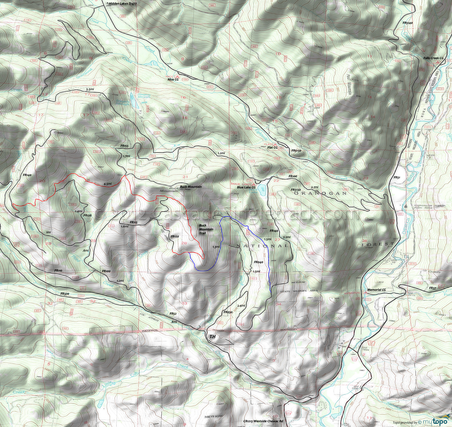
Buck Mountain Trail Mountain Biking and Hiking Topo Map
TH: From the FR025 TH intersection, ascend FR52 (Cub Creek Rd) .8mi, then go right onto FR100 and continue the ascent to FR140. Pass the FR110 intersection on the left at 1.9mi, then pass the FR115 intersection on the right at 2mi and pass the FR126 intersection on the right at 2.6mi.
3.6mi: Go right onto FR140, at the Deer Country interpretive sign, then go right onto the doubletrack trail, which becomes singletrack. With the steepest ascent completed, cross Third Creek, then cross the FR126 intersection at 4.6mi, continuing to traverse just below the Buck Mountain ridgeline.
5.7mi: Cross several creeks then moderately climb to the FR155 intersection. Ascend to the 6.5mi FR115 intersection ride summit, followed by a steep ridgeline descent.
7.8mi: Bear right and drop off the ridgeline, to the 8mi T-intersection. Go left and ride around the hillside in a moderate descent, over to the First Creek drainage.
9.4mi: Cross FR045 and FR040 then cross First Creek and continue the moderate ridgeline descent.
10.8mi: Go right onto FR030 and descend the steep gravel road to the TH.
Draggable map: Map window adjusts to screen size and will respond to touch control. Use scrollbar for mouse control.
No Map? Browser settings and some browser extensions can prevent the maps from appearing. Please see Site Tech


