Twitter Search
#WaltonSnopark
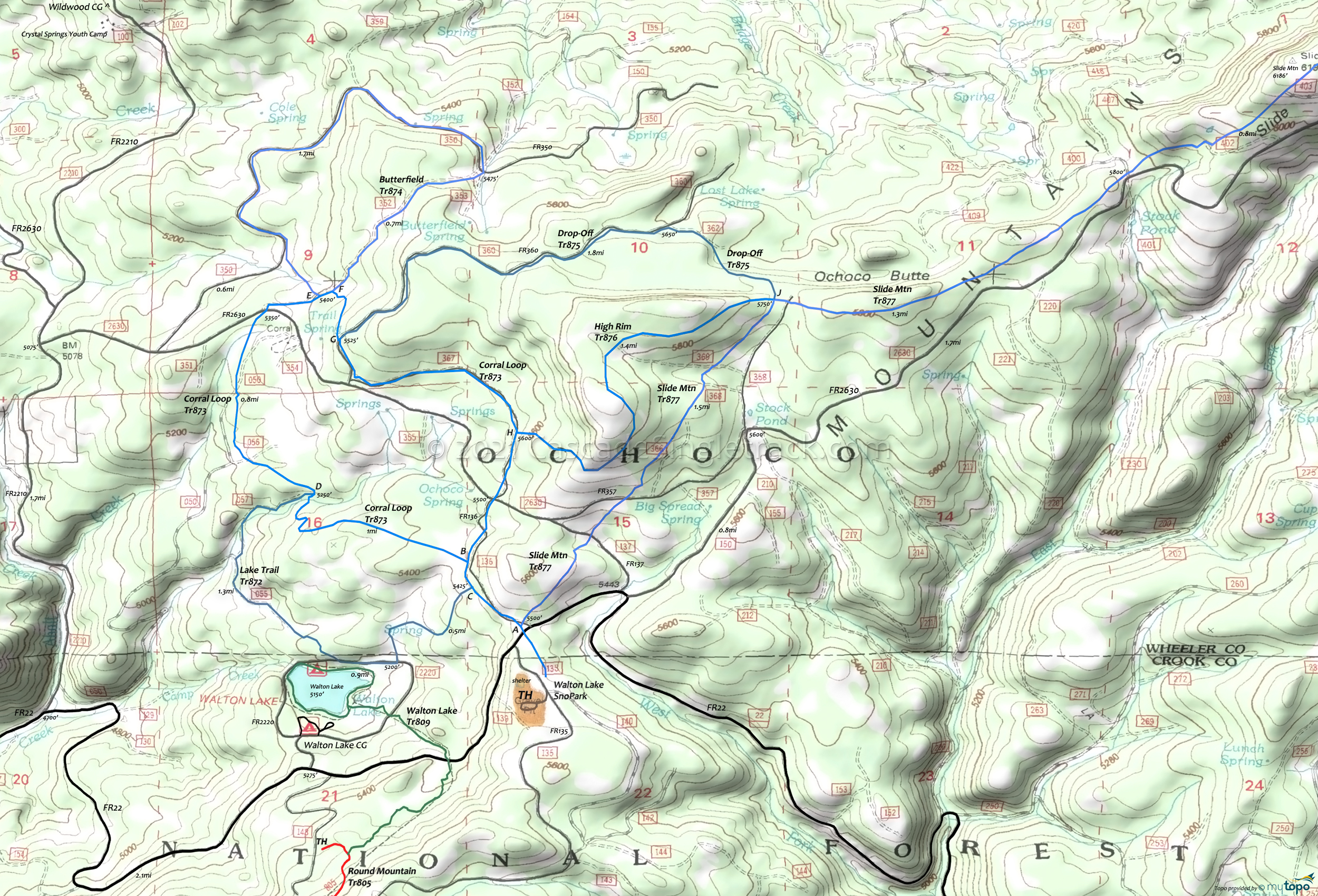
Walton SnoPark XC Trails Topo Map
Map includes: Butterfield Trail 874, Corral Loop Trail 873, Drop-Off Trail 875, High Rim Trail 876, Lake Trail 872, Slide Mountain Trail 877, Walton Lake Trail 809 XC Ski Trails.
The Walton Sno-Park is located at the intersection with FR135 and extends north and east of the lake. Forest Service Page
Intersections are marked as shown on the map.
Corral Loop Tr873 is the basic SnoPark loop, with connections to most of the other trails. Consider a Figure-8 with Butterfield Tr874, or loop back with Lake Tr872.
Drop-Off Tr875 is a connector which offers challenging terrain.
High Rim Tr876 is a ridgeline connector between Corral Loop Tr873 and Slide Mountain Tr877, offering pleasant views.
Slide Mountain Trail 877 is a moderate OAB which can be combined with Drop-Off Tr875. The challenge increased on the final ascent to the Slide Mountain summit.
Draggable map: Map window adjusts to screen size and will respond to touch control. Use scrollbar for mouse control.
No Map? Browser settings and some browser extensions can prevent the maps from appearing. Please see Site Tech


