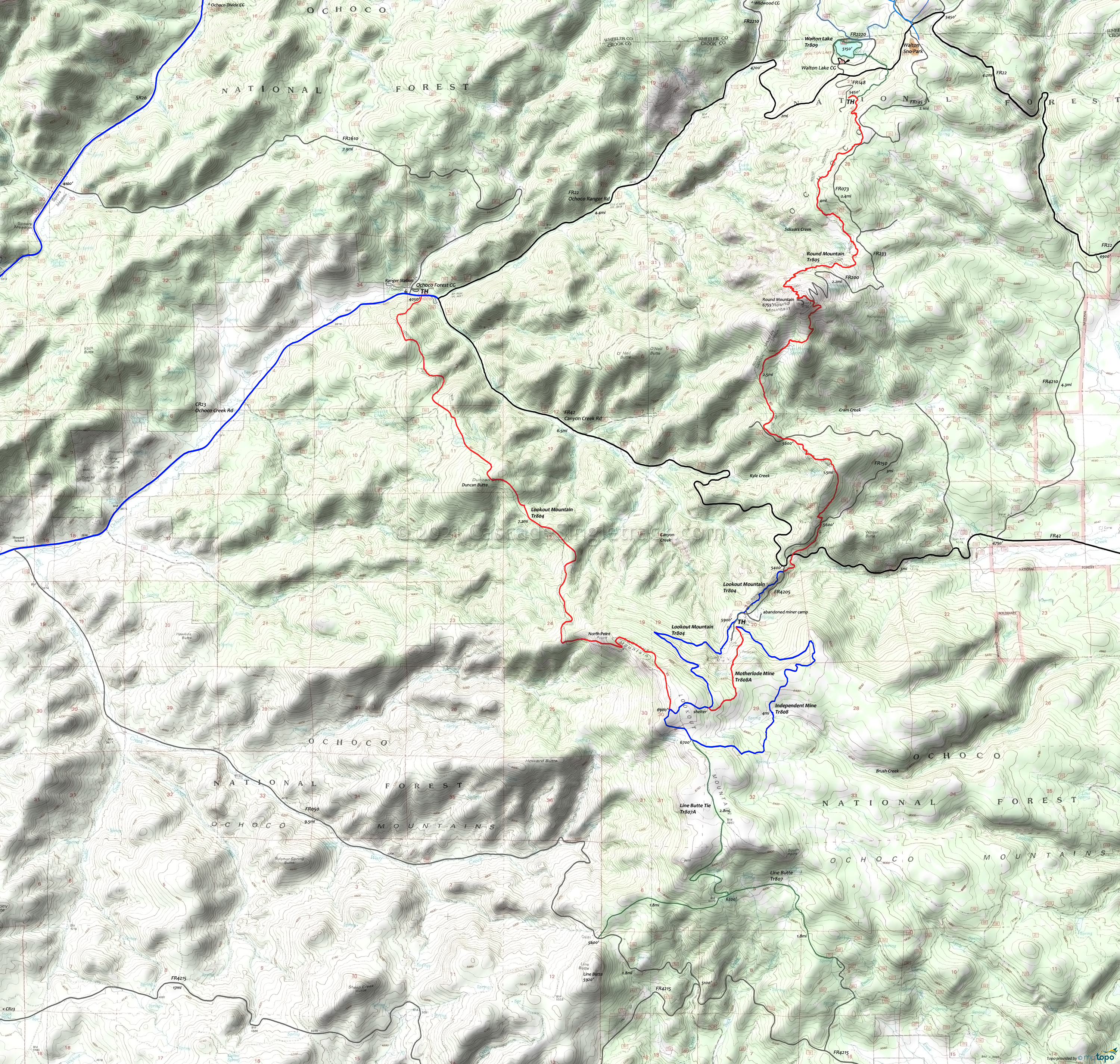
Lookout and Round Mtn Trails Mountain Biking and Hiking Topo Map
Map includes: Lookout Mountain Trail, Independent Mine Trail, Motherlode Mine Trail, Line Butte Tie Trail, Line Butte Trail, Round Mountain Trail, Walton Lake Tr809 Mountain Bike and Hiking Trails.
Lookout Mountain Loop: Go left from the parking area on CR23 (Ochoco Ranger Rd), Past the lower Lookout Mountain Tr804 TH, to FR42 (Canyon Creek Rd).
0.3mi: Go right onto FR42 and ascend 6.6mi to FR4205. Ascend the road or Independent Mine Tr808 to the upper parking area.
7.7mi: Cross the road and find the Independent Mine Tr808 TH and parking area. Ascend the trail to the upper Lookout Mountain Tr804 TH, passing the Line Butte Tr807 on the left at 11.3mi.
11.8mi: Pass the Independent Mine Tr808 intersection and continue on to Lookout Mountain Tr804. Cross the meadows to North Point.
13mi: Descend the steep grade from North Point, then ascend Duncan Butte at 15.6mi.
16.1mi: Pass the Duncan Butte summit and descend to the lower TH. Sections of the trail are narrow and require speed control.
Draggable map: Map window adjusts to screen size and will respond to touch control. Use scrollbar for mouse control.
No Map? Browser settings and some browser extensions can prevent the maps from appearing. Please see Site Tech


