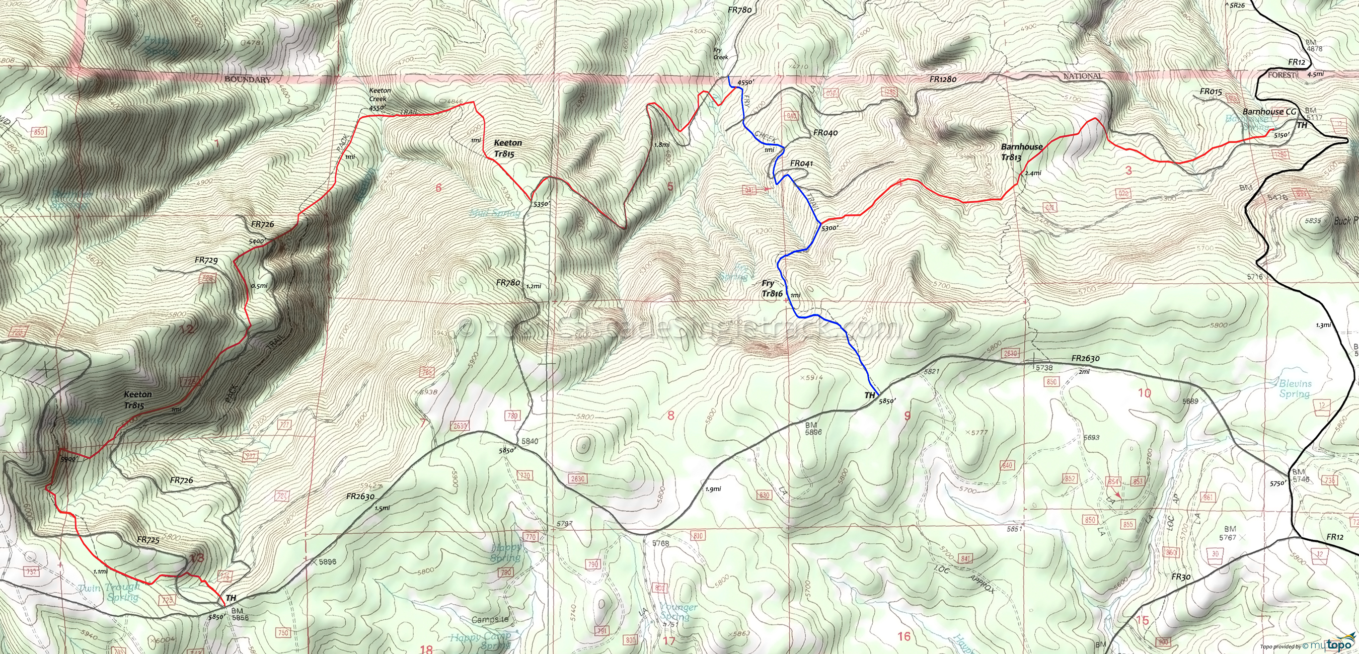
Barnhouse, Keeton Trails Mountain Biking and Hiking Topo Map
Map includes: Barnhouse Trail 813, Fry Trail 816, Keeton Trail 815 Mountain Bike and Hiking Trails.
TH: From the Barnhouse CG, cross FR1280 twice then traverse a side drainage of Mac Creek, followed by a gradual hillside ascent to the Fry Creek Tr816 intersection.
2.4mi: Go right on Fry Creek Tr816 and the switchback descent to the Keeton Tr815 intersection. If the intersection is missed, then either go left onto FR780 or backtrack to find the intersection.
3.3mi: Go left onto Keeton Tr815, which merges with FR780. Continue on FR780.
5.2mi: At the FR780 summit go right onto Keeton Tr815 and descend the steep drainage for 1mi to the Keeton Creek crossing.
6.2mi: Cross Keeton Creek and ascend the steep hillside to the 7mi FR726 crossing. The ascent moderates, crossing FR729 at 7.5mi, then paralleling FR726 for 0.5mi.
8.5mi: Go left at the intersection with an abandoned trail, cross FR725 twice, then complete the ascent to the upper TH.
9.8mi: From the upper TH, return to Barnhouse Tr813. FR726 can provide an alternate route, to avoid excessive treefall.
Draggable map: Map window adjusts to screen size and will respond to touch control. Use scrollbar for mouse control.
No Map? Browser settings and some browser extensions can prevent the maps from appearing. Please see Site Tech


