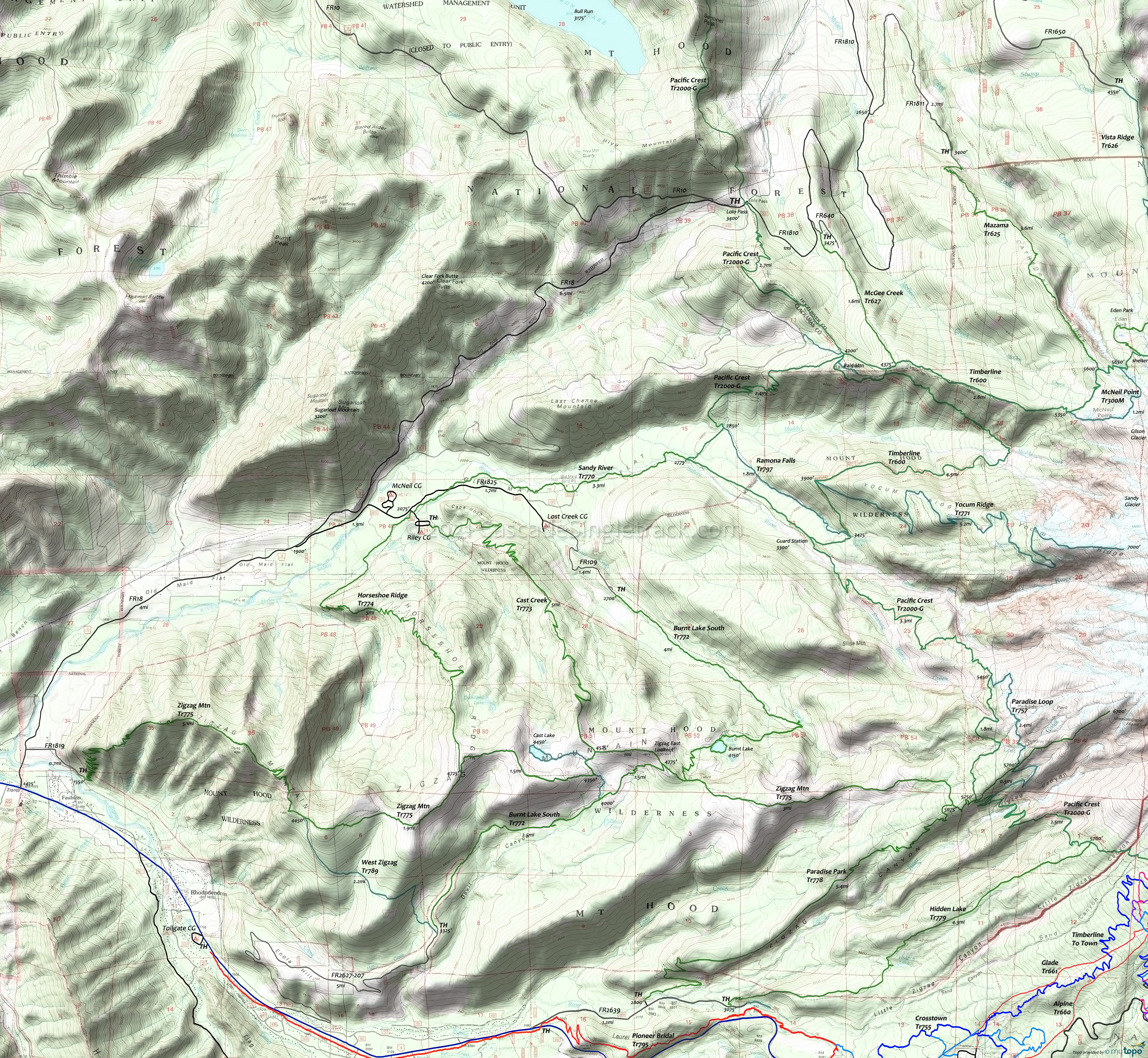
Lolo Pass PCT Wilderness Hiking Topo Map
Twitter Search
#PacificCrestTrail
Mount Hood Wilderness Hiking
Map includes: Hidden Lake Trail 779, Horseshoe Ridge Trail 774, Mazama Trail 625, McGee Creek Trail 627, McNeil Point Trail 600M, Pacific Crest Trail 2000-G, Paradise Park Trail 778, Paradise Park Loop Trail 757, Ramona Falls Trail 797, Sandy River Trail 770, Timberline Trail 600, Vista Ridge Trail 626, Yocum Ridge Trail 771, West Zigzag Trail 789, ZigZag Mountain Trail 775 wilderness hiking trails.
The large Area Maps on the following pages cover most of this trail system Tilly Jane Trail 643, East Fork Trail 650, Sahalie Falls Trail 667C, Timberline Glade Trail 661.
Wilderness permits are required and locator beacons are suggested. Mount Hood Summit info. Don't become a statistic, be prepared, especially if climbing above Timberline Tr600. Consider using a guide if not experienced climbing Mt Hood.
Hidden Lake Tr779 ascends to a small wooded lake through rhododendron bushes, with a challenging 12mi loop created by combining Hidden Lake Tr779 with the Pacific Crest Tr2000 for 2.4mi, then returning 5.6mi on Paradise Park Tr778.
The Riley Horse Camp is the trailhead for the Cast Creek, Horseshoe Ridge and Sandy River trails.
Zigzag Mountain Tr775 is the primary east-west connector from FR18 to Pacific Crest Tr2000, with two abandoned lookout site alongside the trail.
Paradise Park Tr778 is a steady ascent along a forested ridge above the north side of the Zigzag River, eventually accessing Pacific Crest Tr2000 and the Paradise Park alpine meadow with views of Mount Hood.
Yocum Ridge Tr771 ascends to one of the most pristine, fragile and accessible alpine meadows in the Mount Hood Wilderness. Hike 4mi from the Ramona Falls Trailhead to the western Yocum Ridge Tr771 terminus.
Vista Ridge Tr626 is one of the shorter routes to Timerline Tr600 and can be combined with the Eden Park loop. Popular destinations from the Timerline Tr600 intersection include Elk Cove, Barrett Spur, Eden Park, Cairn Basin and Wy'east Basin
The very popular Ramona Falls Tr797 is accessed from Sandy River Tr770 and leads to a very popular falls area, with views of volcanic debris along the way. The Sandy river has a footbridge from Spring to Fall.
Horseshoe Ridge Tr774 western trailhead is 500 feet before the entrance into Riley Campground and starts with the 'Old Maid Flat' area, prior to crossing Lost Creek. The trail enters alpine forest and can be looped with Cast Creek Tr773.
Draggable map: Map window adjusts to screen size and will respond to touch control. Use scrollbar for mouse control.
No Map? Browser settings and some browser extensions can prevent the maps from appearing. Please see Site Tech


