
Surveyors Ridge Trail Area Mountain Biking and Hiking Topo Map
Twitter Search
#OregonTimberTrail
Map includes: Dog River Trail 675, Oak Ridge Trail 688A, Surveyors Ridge Trail 688, Zig Zag Trail 678, North Section Trail, Super Connector Trail, The Hub Mountain Biking and Hiking Trails.
Oregon Timber Trail: Surveyors Ridge Trail 688 and Oak Ridge Trail 688A are part of the Hood Tier route.
Surveyors Ridge (FR44 TH) OAB
Ride starts with singletrack alongside FR44, to the second creek crossing, a fast, relatively flat section with a few waterbar jumps along the way.
1.6mi: At Cooks Meadow, go straight just before the small creek (crossing the creek was the old route), then go for 3.6mi over a knoll to the FR17 intersection with Super Connector trail road. Option: use The Hub to access Super Connector.
5mi: After a little section of fast, winding singletrack, go around a scree field then cross FR680. After passing several view points, with some short ascents, pass Shellrock Mountain at 8.2mi. 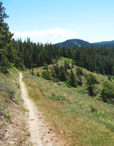
9.7mi: After a short but steep ascent, descend to a FR17 intersection, just south of Gibson Prairie Horse Camp. This is followed by another steep ascent, to FR671.
10.6mi: Cross FR671 as the descent intensifies as the ridgeline drops off to the next FR17 TH.
11.2mi: Descend to Yellowjacket Creek, followed by a short climb to a view point. This is followed by a steep descent to the Oak Ridge Tr688A upper TH
12.7mi: From the Oak Ridge Tr688A upper TH the trail continues to drop off sharply to FR630 and the power line TH. Trail continues for 3.5mi, past Bald Butte to the northern FR17 TH.
 OAB Elevation Profile")
Dog River Surveyors Epic
This is a 24.5mi (5200' ascent) CCW loop, consisting of Dog Rvr Tr675 to Surveyors Rdg Tr688, ending with a wild bombing run on Oak Rdg Tr688A.
TH: From the Oak Rdg Tr688A TH, go to SR35 then climb 500' on SR35S to the Dog Rvr Tr675 TH.
3.7mi: Climb 6.6mi (2500' ascent) on Dog River Tr675 to FR620, then go 2.6mi further to the Surveyors Ridge Tr688 TH.
10.9mi: Ride Surveyors Rdg Tr688 to the 1850' Oak Rdg Tr688A descent back to the TH.

Draggable map: Map window adjusts to screen size and will respond to touch control. Use scrollbar for mouse control.
No Map? Browser settings and some browser extensions can prevent the maps from appearing. Please see Site Tech

