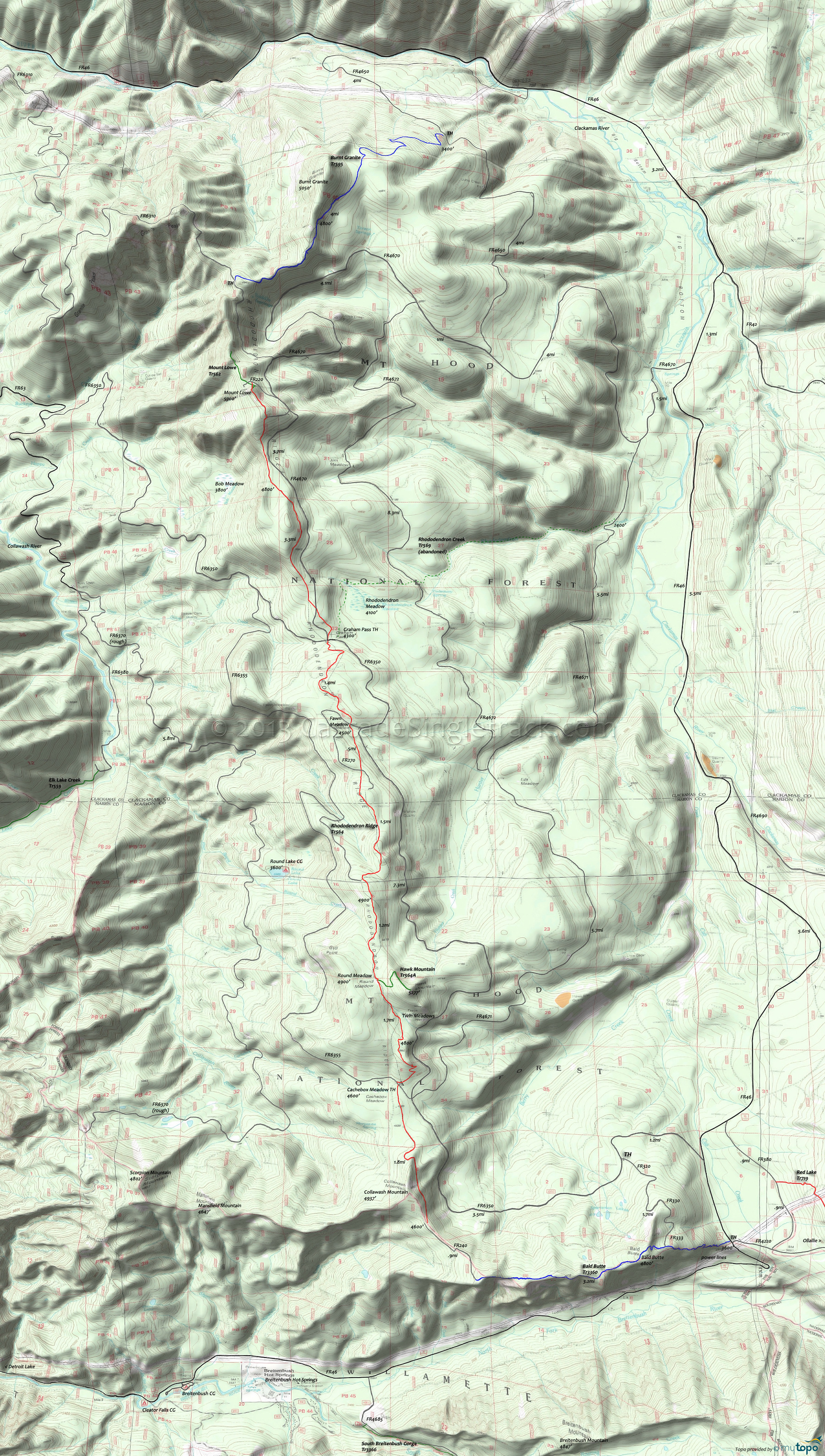
Rhododendron Ridge Trail 564 Area Mountain Biking and Hiking Topo Map
Map includes: Bald Butte Trail 3360, Burnt Granite Trail 595, Hawk Mountain Trail 564A, Mount Lowe Trail 562, Rhododendron Creek Trail 569, Rhododendron Ridge Trail 564 Mountain Biking and Hiking Trails.
Rhododendron Ridge OAB
TH: Ascend through a hillside meadow to the ridgeline from Cachebox Meadow. Pass the Hawk Mountain Tr564A intersection on the right at 1.7mi, near Round Meadow.
2.6mi: After completing the third ascent, start the steady descent to Graham Pass. Watch for treefall and keep the speed under control.
4.4mi: Cross FR270, then descend to the Fawn Meadow FR270 crossing at 5mi.
6.1mi: Cross FR6350 at Graham Pass, then ascend steeply up the ridge for 1.2mi, traverse a knoll then complete the Mount Lowe ascent. Pass FR026 on the right at the 8.9mi ride summit.
9.4mi: Turnaround near the Mount Lowe peak, and return to the TH. Option: use FR6350 to return from Graham Pass to Cachebox Meadow.
Draggable map: Map window adjusts to screen size and will respond to touch control. Use scrollbar for mouse control.
No Map? Browser settings and some browser extensions can prevent the maps from appearing. Please see Site Tech


