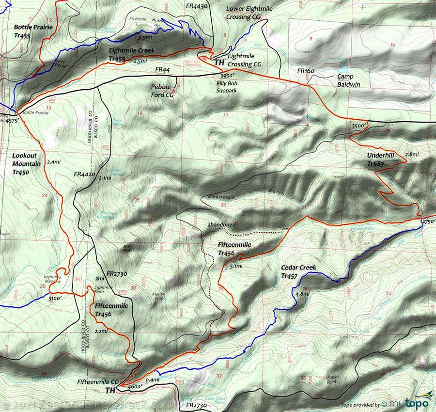
Eightmile Creek Trail 459, Fifteenmile Trail 456 and Lookout Mountain Trail 450 Area Mountain Biking and Hiking Topo Map
Map includes Cedar Creek Trail 457, Eightmile Creek Trail 459, Fifteenmile Trail 456, Lookout Mountain Trail 450, Underhill Trail 683 Mountain Biking and Hiking Trails.
Eightmile, Lookout, Fifteenmile, Underhill CCW Loop
TH: From the Eightmile Crossing campground, switchback on Eightmile Cr Tr459 then cross FR4420 and go left at the fork, to remain on Eightmile Cr Tr459.
2.7mi: At the Bottle Prairie campground, cross FR44 and continue the moderate ascent on Lookout Mountain Tr450, alongside Eightmile Creek. Pass an access trail on the left at 4.5mi, then ride to the Eightmile Meadow intersection.
5.2mi: Go left onto Fifteenmile Tr456, cross FR4420 and reach the Eightmile Point ride summit at 5.5mi, then descend to Fifteenmile Creek campground.
6.9mi: Ride through the Fifteenmile Creek campground and descend Fifteenmile Tr456, passing the Cedar Creek Tr457 intersection on the right at 7.5mi. From 8.2mi, the trail parallels and crosses FR4750 several times, for 1.5mi, before breaking off to the right and descending Fifteenmile Creek.
12.6mi: Go left onto Underhill Tr683 and hike-a-bike for .9mi alongside a creek, then descend to FR44.
15mi: Go left onto FR44 and ride to FR4430 and back to the Eightmile Crossing campground TH.
Draggable map: Map window adjusts to screen size and will respond to touch control. Use scrollbar for mouse control.
No Map? Browser settings and some browser extensions can prevent the maps from appearing. Please see Site Tech


