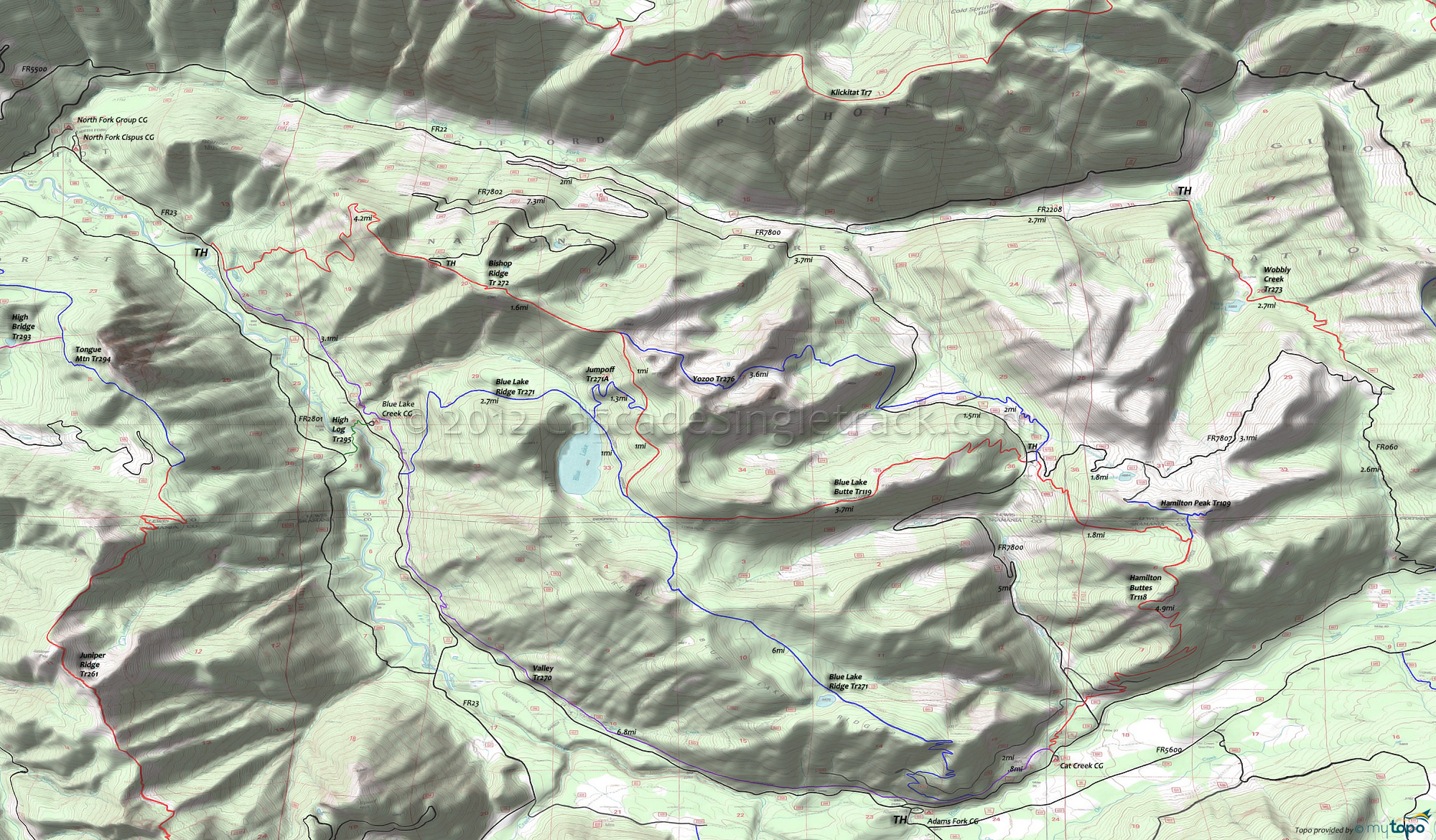
Valley Trail 270 and Wobbly Creek Trail 273 Area Mountain Biking and Hiking Topo Map
Map includes: Bishop Ridge Trail 272, Blue Lake Ridge Trail 271, Hamilton Buttes Trail 118, Jumpoff Trail 271A, Valley Trail 270, Wobbly Creek Trail 273, Yozoo Tr276 Mountain Biking and Hiking Trails.
TH: From the Cat Creek TH, go to intersection with Valley Tr270 and then go right onto Hamilton Buttes Tr118. At .8mi, cross FR78, then continue climbing steadily through a series of switchbacks to the top of the butte.
4.5mi: Reach the summit at 2675', then descend 2.2mi to the intersection with Blue Lk Butte Tr119 and Yozoo Tr276.
6.7mi: Go left onto Blue Lk Butte Tr119 and climb along the ridgeline, before descending to Blue Lk Rdg Tr271.
10.5mi: Go left on Blue Lk Rdg Tr271 and ride along Blue Lake Ridge.
14.1mi: Descend 2250' through a series of wild, swooping switchbacks for 2.2mi to Valley Tr270, then go left back to TH.
Draggable map: Map window adjusts to screen size and will respond to touch control. Use scrollbar for mouse control.
No Map? Browser settings and some browser extensions can prevent the maps from appearing. Please see Site Tech


