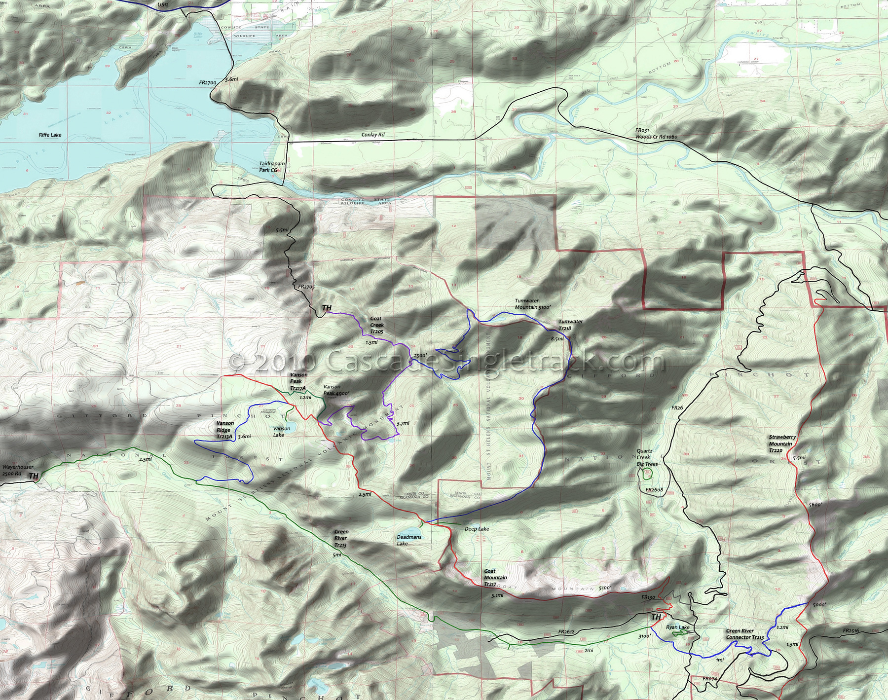
Tumwater Trail 218 Area Mountain Biking and Hiking Topo Map
Map includes: Goat Mountain Trail 217, Green River Trail 213, Tumwater Trail 218, Vanson Peak Trail 217A, Vanson Ridge Trail 213A Mountain Biking and Hiking Trails.
TH: From the FR2750 TH, ascend gradually for 1.5mi, passing waterfalls and crossing several creeks.
1.5mi: Go right at the Tumwater Tr218 intersection, to stay on Goat Cr Tr205, maybe questioning whether this was a smart idea as the trail climbs and switchbacks unrelentingly for 3.7mi to the Goat Mt Tr217 intersection. The .5mi section of flat terrain at the 4mi mark sets up the final push to the top.
5.2mi: Reach Goat Mt Tr217 and go left, with a brief climb followed by gradually descending undulating ridgeline terrain. As a 2mi option, go right onto Vanson Pk Tr217A and climb 800' to the summit, then ride out to the western Goat Mt Tr217 TH, then ride to Tumwater Tr218.
7.5mi: Go left onto Tumwater Tr218 (maybe taking a break at Deadmans Lake), ascending rocky outcroppings and meadows to the summit of Tumwater Mountain at the 12mi mark.
13.1mi: After passing a small lake, begin the steep switchbacking descent to Goat Creek.
16mi: Go right onto Goat Cr Tr205 and return to the TH.
Draggable map: Map window adjusts to screen size and will respond to touch control. Use scrollbar for mouse control.
No Map? Browser settings and some browser extensions can prevent the maps from appearing. Please see Site Tech


