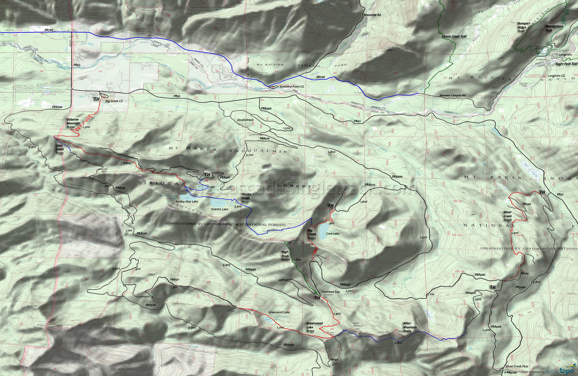
Osborne Mountain Trail 250 and Teeley Creek Trail 251 Area Mountain Biking and Hiking Topo Map
Map includes: Allen Mountain Trail 269, Big Creek Trail 252, Cave Creek Trail 255, Greenwood Lake Trail 253, High Rock Trail 266, Osborne Mountain Trail 250 and Teeley Creek Trail 251 Mountain Biking and Hiking Trails.
TH: From the northern Big Creek Tr252 TH, ascend .9mi past Big Creek Falls and Cora Lake, to the Teeley Creek Tr251 intersection at the base of High Rock Mountain.
.9mi: Go right onto Teeley Creek Tr251 and ride the base of Sawtooth ridge, over rugged terrain past Granite and Bertha May lakes.
4.2mi: Just past Bertha May lake, reach Osborne Mt Tr250 at a T intersection. Continue on Osborne Mt Tr250. Ascend through a dense conifer forest over a sandy trail surface (might have to hike-a-bike some of this), merging with FR8410 at 4.85mi. The trail merges and leaves FR8410 several times before exiting the left side of the road at 5.2mi.
6.3mi: Turn around and return to the TH. Beyond this point, Osborne Mtn Tr250 begins the descent to the Big Creek campground.
Draggable map: Map window adjusts to screen size and will respond to touch control. Use scrollbar for mouse control.
No Map? Browser settings and some browser extensions can prevent the maps from appearing. Please see Site Tech


