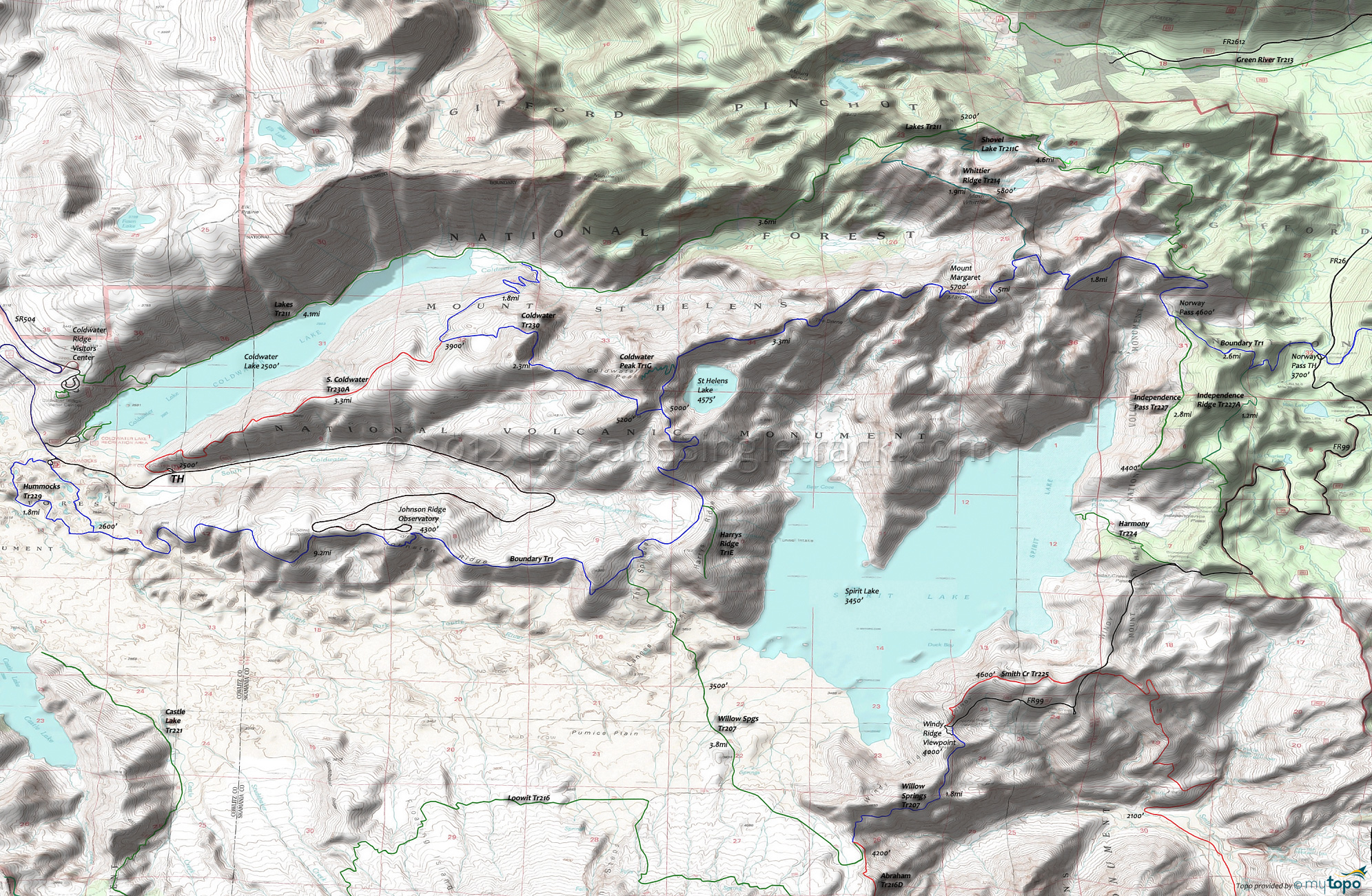
Mount Margaret: Boundary Trail 1 and Coldwater Trail 230 Area Mountain Biking and Hiking Topo Map
Map includes Boundary Trail 1, Coldwater Trail 230, Hummocks Trail 229, Independence Pass Trail 227, Panhandle Lake Trail 211B and Whittier Ridge Trail 214 Mountain Biking and Hiking Trails.
TH: Steady 1550' switchback ascent for 3.2mi on South Coldwater Tr230A, past some logging equipment destroyed from the 1980 eruption.
3.2mi: Go right onto Coldwater Tr230 and climb 1400' over 2.4mi, an 11% grade.
5.6mi: Go left onto Boundary Tr1 and climb the undulating ridgeline terrain past the Coldwater Peak Tr1G intersection and Saint Helens Lake at 6mi, then pass The Dome at 7.3mi, reaching the Mount Margaret ride summit at 8.9mi.
8.9mi: Turn around and head back to SR504 on Boundary Tr1. Pass the Coldwater Tr230 intersection and descend past the Harrys Ridge Tr1E intersection at 13.9mi. Traverse The Spillover, passing the Willow Springs Tr207 intersection on the left at 14.9mi, then ride the flat ridgeline terrain to the Johnson Ridge Observatory.
17.1mi: Just past the Johnson Ridge Observatory, Boundary Tr1 breaks into a steep, 3.5mi switchback descent to SR504, with 1mi of flat terrain just prior to reaching the road. Pass the Hummocks Tr229 intersection on the left at 20.6mi.
21.6mi: Go right onto SR504 and ride .9mi to the TH.
Draggable map: Map window adjusts to screen size and will respond to touch control. Use scrollbar for mouse control.
No Map? Browser settings and some browser extensions can prevent the maps from appearing. Please see Site Tech


