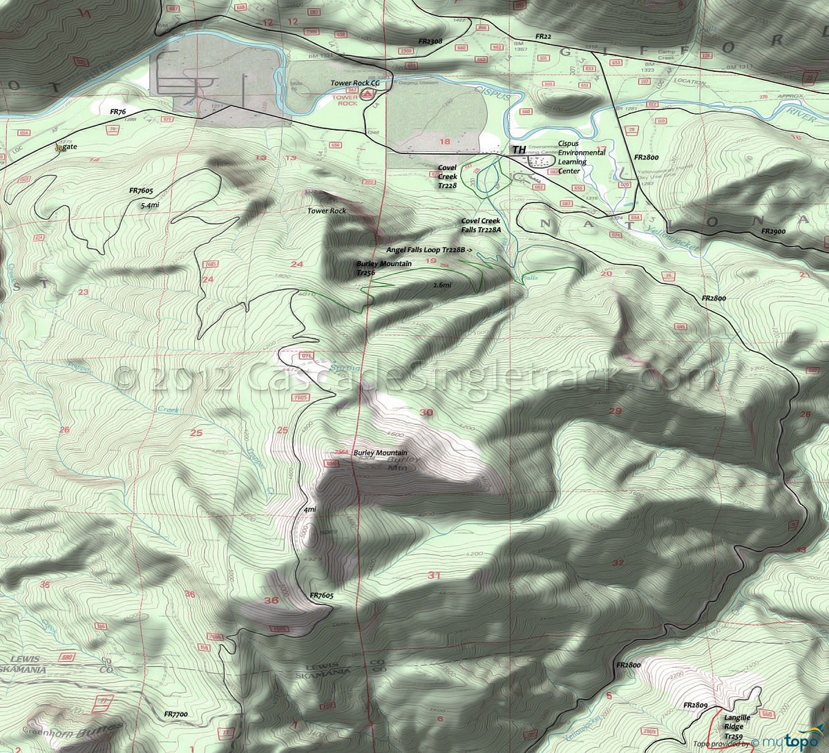
Burley Mountain Trail 256 Area Hiking Topo Map
Map includes: Angel Falls Loop Trail 228B, Burley Mountain Trail 256, Cispus Nature Trail 223, Covel Creek Trail 228, Covel Creek Falls Trail 228A, French Creek Trail 5C and Snagtooth Trail 4 Hiking Trails.
Burley Mountain Hiking: The nearby Cispus Environmental Learning Center features several short hiking loops, with Burley Mountain Tr256 as the main hike.
With most of the terrain moderate for family hikes, Covel Creek Tr228 leads to Covel Creek Falls Tr228A, with a slightly more advanced descent on Angel Falls Loop Tr228B, which passes underneath a Covel Creek waterfall.
Burley Mountain Tr256 ascends at a steady pace through the remnants of early 1900's Cispus Valley forest fires, with black stumps remaining from the old forest. Not drawn, the Burley Mountain Lookout Tr256A leads to the 1934 Burley Mountain Lookout, one of three Gifford Pinchot lookouts still in use.
Covel Creek Tr228 ascends through mixed hardwood and conifer forest along Covel Creek, used by the Cispus Center for nature study.
The Area Map shows a more advanced day-hike, with a CCW loop of Boundary Tr1, Snagtooth Tr4, Quartz Creek Tr5 and French Creek Tr5C, using FR2900 as the TH.
Draggable map: Map window adjusts to screen size and will respond to touch control. Use scrollbar for mouse control.
No Map? Browser settings and some browser extensions can prevent the maps from appearing. Please see Site Tech


