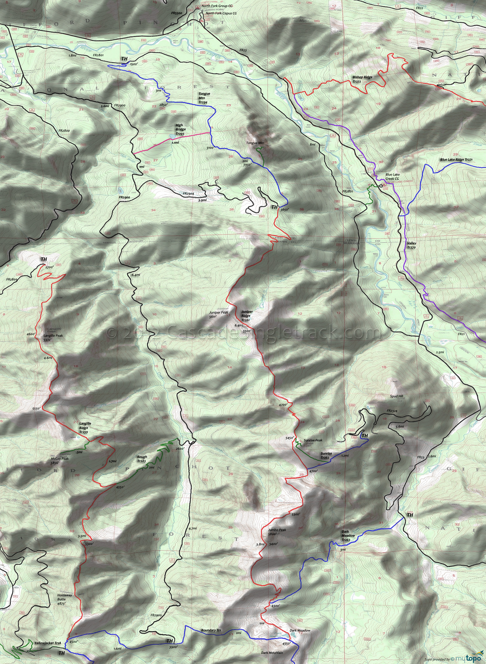
Juniper Ridge Trail 261 and Tongue Mtn Trail 294 Area Mountain Biking and Hiking Topo Map
Map includes Dark Meadow Trail 263, High Bridge Trail 293, Juniper Ridge Trail 261, Sunrise Trail 262, Tongue Mtn Trail 294 Mountain Biking and Hiking Trails.
TH: Ascend 1800' over 2.8mi through small conifers to Juniper Ridge. Follow the ridgeline to the base of Sunrise Peak.
5.7mi: Pass Sunrise Peak Tr261A, then descend to a meadow and pond. Pass the Sunrise Tr262 intersection then ascend the ridge to Jumbo Peak.
8mi: Reach Jumbo Peak then descend sharply to Dark Meadow Tr263 at 10.2mi, through some sharp switchback turns.
11.5mi: Reach Dark Meadow lake, at the base of Dark Mountain and the Boundary Tr1 intersection. Head back to TH.
Draggable map: Map window adjusts to screen size and will respond to touch control. Use scrollbar for mouse control.
No Map? Browser settings and some browser extensions can prevent the maps from appearing. Please see Site Tech


