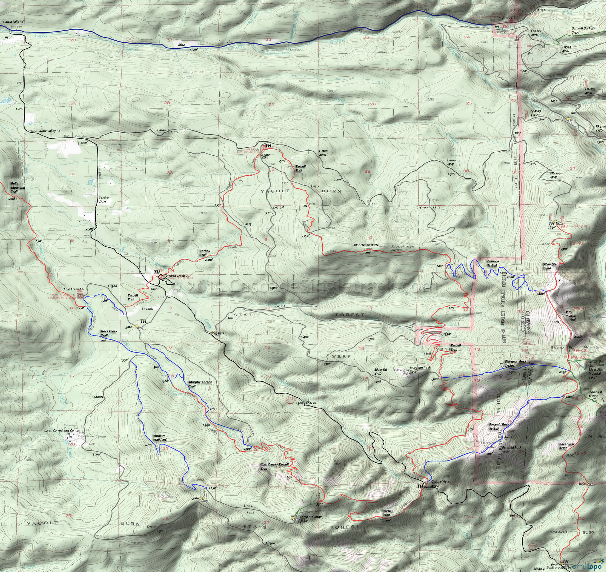
Grouse Vista: Sturgeon Rock Trail 180C Area Mountain Biking and Hiking Topo Map
Map includes: Chinook Trail 180B, Pyramid Rock Trail 180F, Silver Star Summit Trail 180D, Sturgeon Rock Trail 180C, Tarbell Trail Mountain Biking and Hiking Trails.
TH: Steep .9mi ascent to Pyramid Rock, with .4mi across the summit, then .8mi of steep climbing to Silver Star Tr180.
2.1mi: But wait, there's more.. Grind out another .5mi to finish the summit climb, then at 2.6mi, maybe go check out Indian Pit Tr180E.
3.7mi: Descend from Silver Star summit, then go left on Chinook Tr180B for a fast switchback ride to Tarbell Trail.
6.5mi: Go left at the Tarbell Trail and descend to the Coyote Creek Falls.
8.1mi: Cross the creek and begin 1000' switchback climb to Sturgeon Rock summit. Bail out point: In the first switchback, there is a jeep trail which leads to L1210.
10.2mi: At the Sturgeon Rock summit, pass the Sturgeon Rock Tr180C intersection, then begin 500' descent to Rock Creek Falls. Cross Rock Creek and continue on to the Grouse Creek Vista TH. Bail out point: At the Sturgeon Rock summit, there is a jeep trail which leads to L1210.
Draggable map: Map window adjusts to screen size and will respond to touch control. Use scrollbar for mouse control.
No Map? Browser settings and some browser extensions can prevent the maps from appearing. Please see Site Tech


