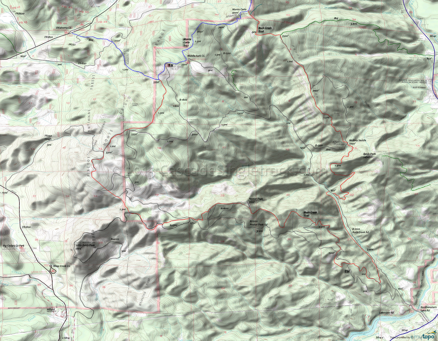
Buck Creek Trail Mountain Biking and Hiking Topo Map
TH: Start with a steep 1mi ascent, then cross the road twice and cross several streams before the main ascent begins.
2.3mi: Begin the 2.2mi (15% grade) Nestor Pk ascent, then ease into an undulating climb for the rest of the way to Monte Carlo Mt.
5.7mi: Cross N1000 then cross and briefly merge with several fire roads before reaching FR050.
8.5mi: Go right onto FR050, and go .6mi to the intersection with B1000 and N1000, then go north onto Monte Carlo Tr52.
10.4mi: Go right at T intersection with Monte Carlo Tr52 and ride to the Monte Carlo summit, passing the upper Buck Cr TH and Middle Fork CG along the way.
12.9mi: Complete brief, steep switchback climb to the Monte Carlo summit, then go right onto Buck Creek Trail.
13.8mi: Go right onto doubletrack and rapidly descend to hairpin curve at mile 15, then continue steep descent on singletrack.
16.4mi: Cross fire road at Mcllroy Saddle, then begin steep switchback descent through several drainages, down to B1000.
18.8mi: Go right (uphill) on B1000 to rejoin the trail, near the pullout, then ride alongside Buck Creek before trail pulls away from the road and returns to the TH.
Draggable map: Map window adjusts to screen size and will respond to touch control. Use scrollbar for mouse control.
No Map? Browser settings and some browser extensions can prevent the maps from appearing. Please see Site Tech


