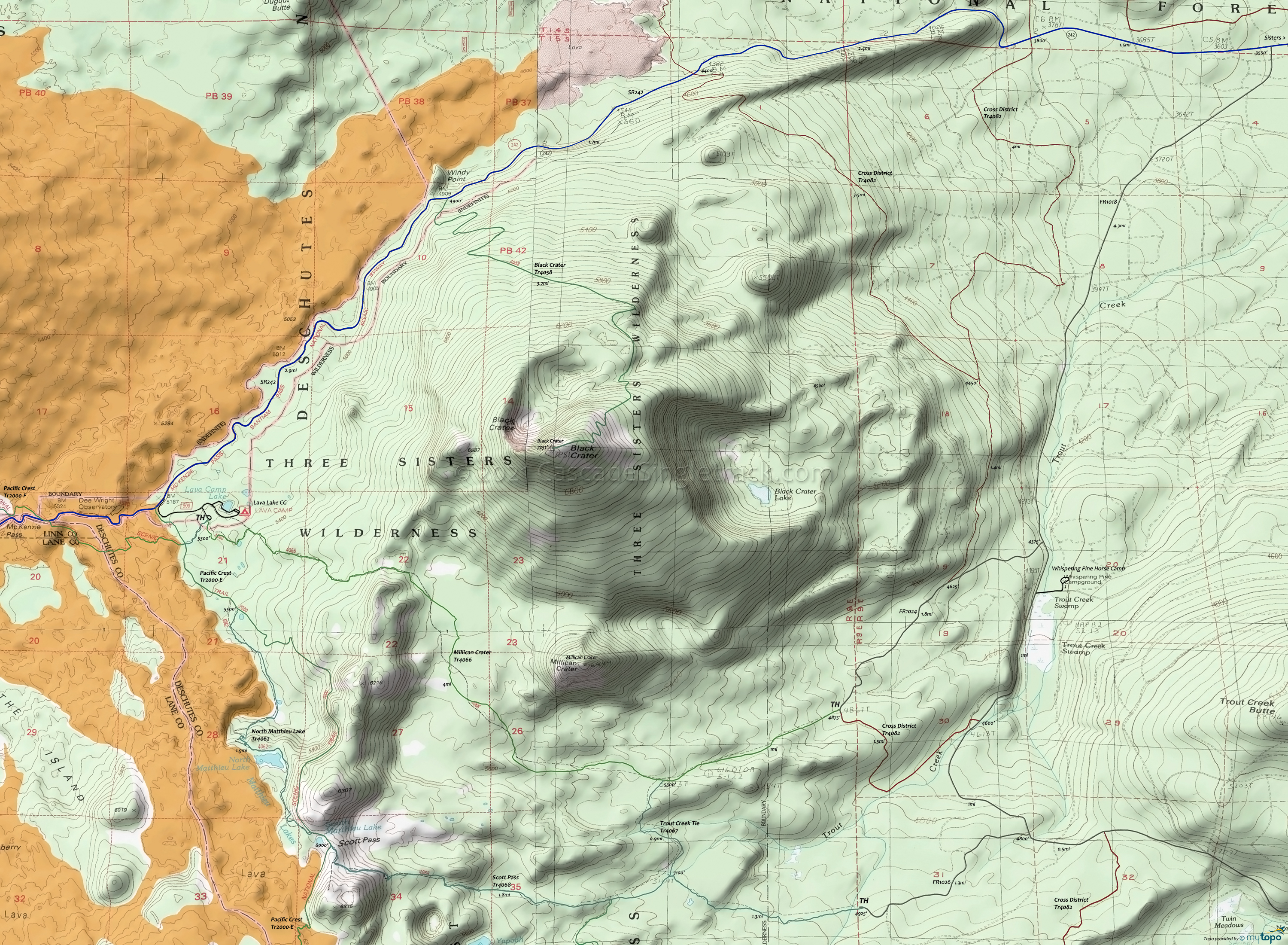
Black Crater Area Area Hiking Topo Map
Twitter Search
#PacificCrestTrail
Map includes Lava Camp Lake Trail 4060, Millican Crater Trail 4066, North Matthieu Lake Trail 4062, Pacific Crest Trail 2000-E, Scott Pass Trail 4068, Trout Creek Tie Trail 4067 Hiking Trails.
This map covers the northern section of the Three Sisters Wilderness area, at the border with the Mount Washington Wilderness area.
Starting in 2021, the Mt. Jefferson, Mt. Washington, and Three Sisters Wilderness Areas will require a Central Cascades Wilderness Permit for Day or Overnight use, from May 28th to Sept 24th.
Several trailheads provide relatively easy access to a day hike loop. A CW loop would consist of Millican Crater Trail 4066, Trout Creek Tie Trail 4067, Scott Pass Trail 4068, North Matthieu Lake Trail 4062 or Pacific Crest Trail 2000-E, returning on Lava Camp Lake Trail 4060.
Nearby Lava Camp Lake provides access to the south side of Black Crater, with hiking to Scott Pass and Matthieu Lake.
Cross District Trail 4082 can be used to complete a shuttle hike, providing access to the east side of Black Crater.
Some of this area was affected by the 2012 Pole Creek fire. Check with the Sisters Ranger Station for current trail conditions.
Draggable map: Map window adjusts to screen size and will respond to touch control. Use scrollbar for mouse control.
No Map? Browser settings and some browser extensions can prevent the maps from appearing. Please see Site Tech


