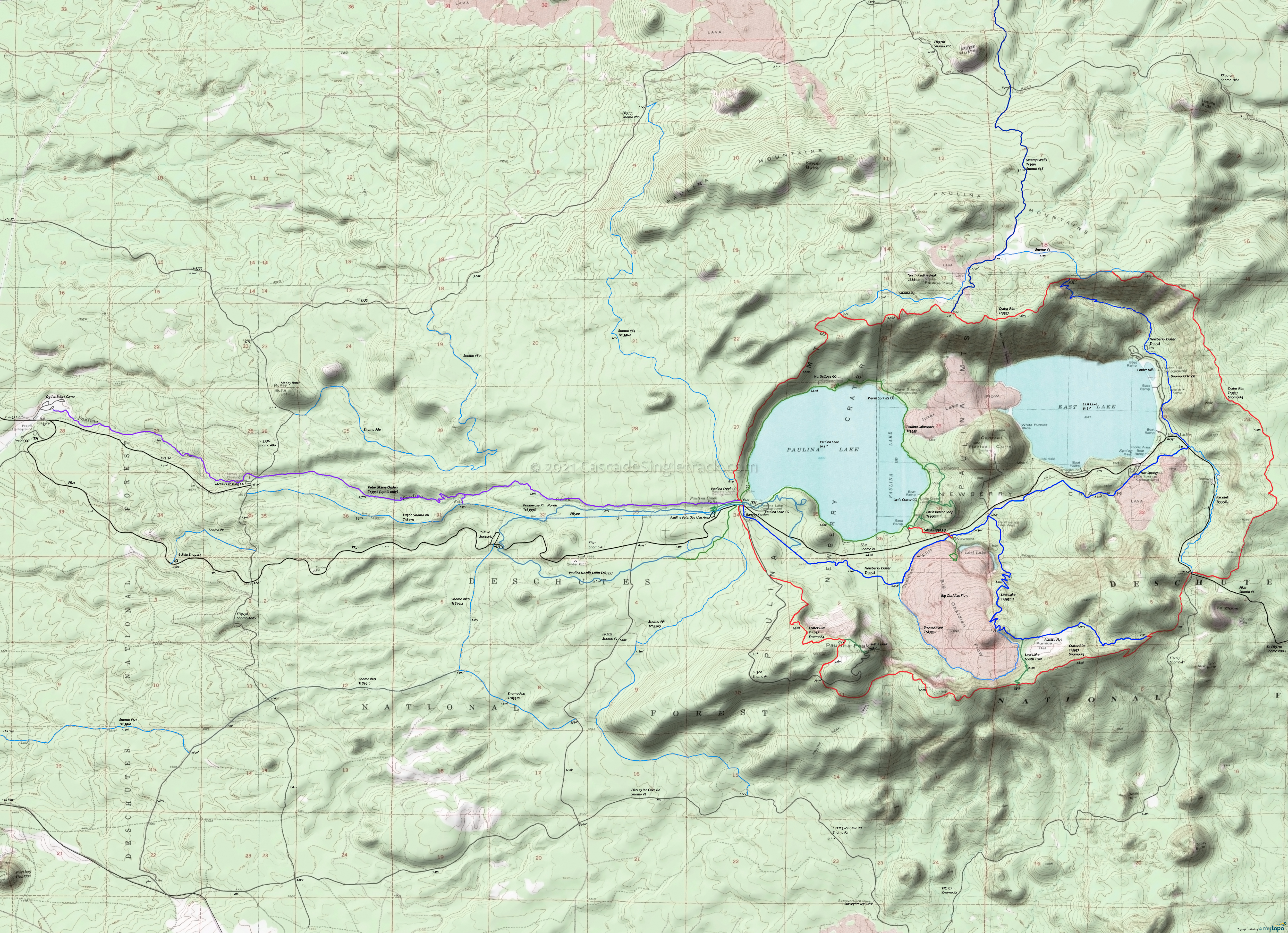
Newberry Crater Area Mountain Biking, Hiking and Nordic Topo Map
Map includes Crater Rim Trail 3957, Newberry Crater Trail 3958, Newberry #4 Trail 83904, Lost Lake Tr3958.2, Parallel Trail 3958.3, Peter Skene Ogden Trail 3956 and Silica Trail 3925.5 Mountain Biking and Hiking Trails.
Includes Nordic and Snomobile trails, with some roads serving as Snomobile trails where noted.
TH: Go east on FR21 from the visitors center for .2mi, then cross FR21 onto FR500 and ascend Paulina Peak. Go right onto Crater Rim Tr3957 at 3mi, the end of the main ascent unless continuing on to the Paulina Peak summit. Pass the Lost Lake Tr3958.2 intersection on the left at 7.5mi, then briefly ride alongside FR2127 before crossing it (at an FR21 3-way) at 8.5mi, at the intersection with Parallel Tr3958.3. Bear right to stay on Crater Rim Tr3957.
13.3mi: After a gradual ascent along the eastern rim, pass a snowmobile track at 13.3mi, 13.7mi and 14mi, then pass the Newberry Crater Tr3958 intersection on the left at 14.2mi. Pass another snowmobile track on the right at 15.8mi (near North Paulina Peak), then begin the west descent, over loose terrain. The northside terrain is quite rugged and occasionally steep.
Draggable map: Map window adjusts to screen size and will respond to touch control. Use scrollbar for mouse control.
No Map? Browser settings and some browser extensions can prevent the maps from appearing. Please see Site Tech


