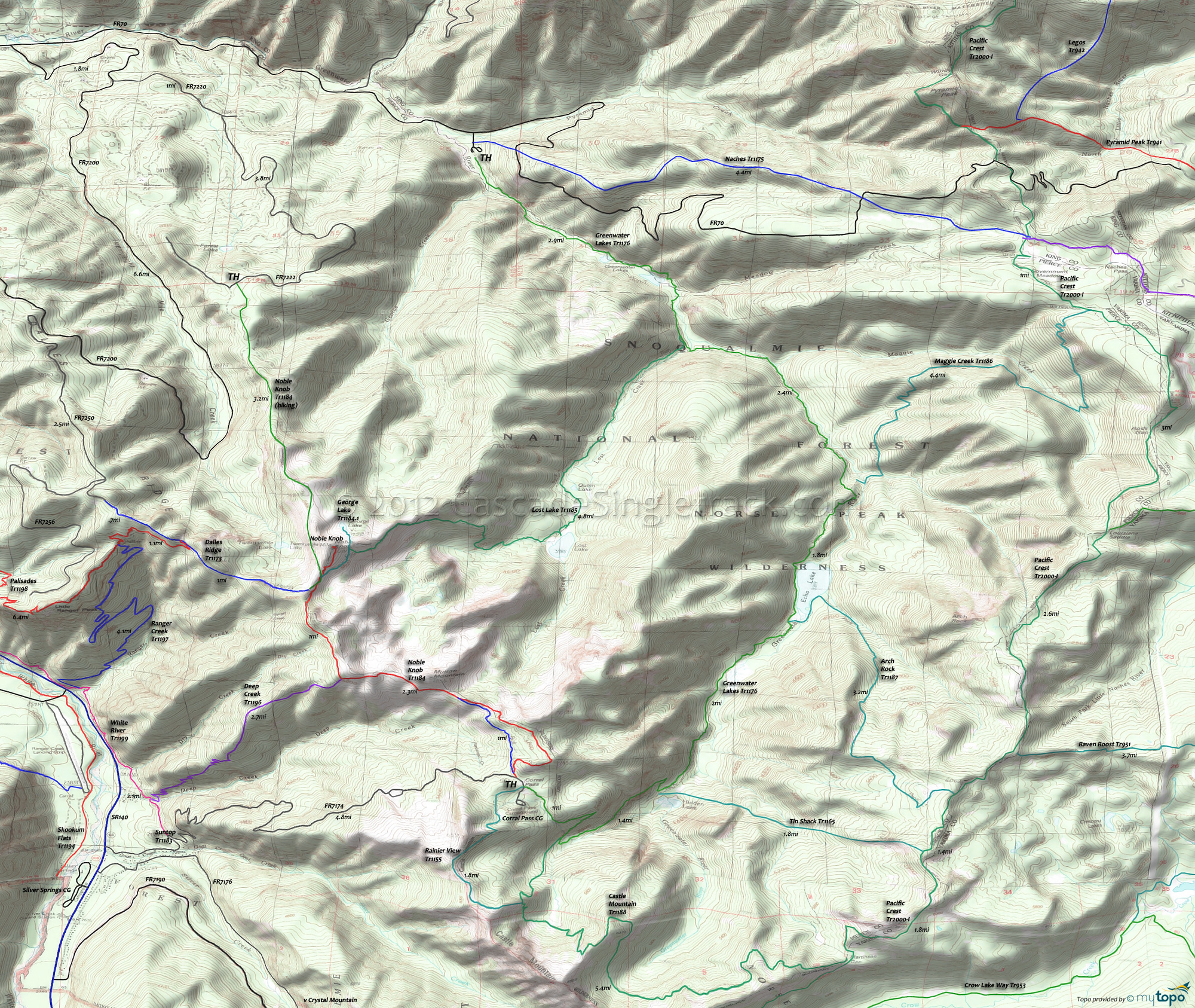
Norse Peak Wilderness and Greenwater Lakes Trail 1176 Area Hiking Topo Map
Twitter Search
#PacificCrestTrail
Map includes: Arch Rock Trail 1187, Castle Mountain Trail 1188, Greenwater Lakes Trail 1176, Lost Lake Trail 1185, Maggie Creek Trail 1186, Naches Trail 1175, Pacific Crest Trail 2000-I, Rainier View Trail 1155 and Tin Shack Trail 1165.
Norse Peak Wilderness hiking: The Greenwater Lakes Tr1176 TH and the Corral Pass CG serve as the north and south trailheads for a section of Norse Peak Wilderness, over to the Pacific Crest Tr2000-I.
Naches Tr1175 is open to biking from FR7065 to the Naches Pass, and (along with Pyramid Peak Tr941) leads to the Bear Creek Tr943 ride.
Greenwater Lakes Tr1176 is the main N-S trail, along with Pacific Crest Tr2000-I, with Maggie Creek Tr1186, Arch Rock Tr1187, Tin Shack Tr1165 and Castle Mountain Tr1188 connections to the PCT.
The unmaintained Maggie Creek Tr1186 can be a navigational and hiking challenge, with a hazardous Greenwater River crossing near the intersection with Greenwater Lakes Tr1176. These trails all venture through old-growth timber, with very steep grades on the ascent options to the PCT ridgeline.
Draggable map: Map window adjusts to screen size and will respond to touch control. Use scrollbar for mouse control.
No Map? Browser settings and some browser extensions can prevent the maps from appearing. Please see Site Tech


