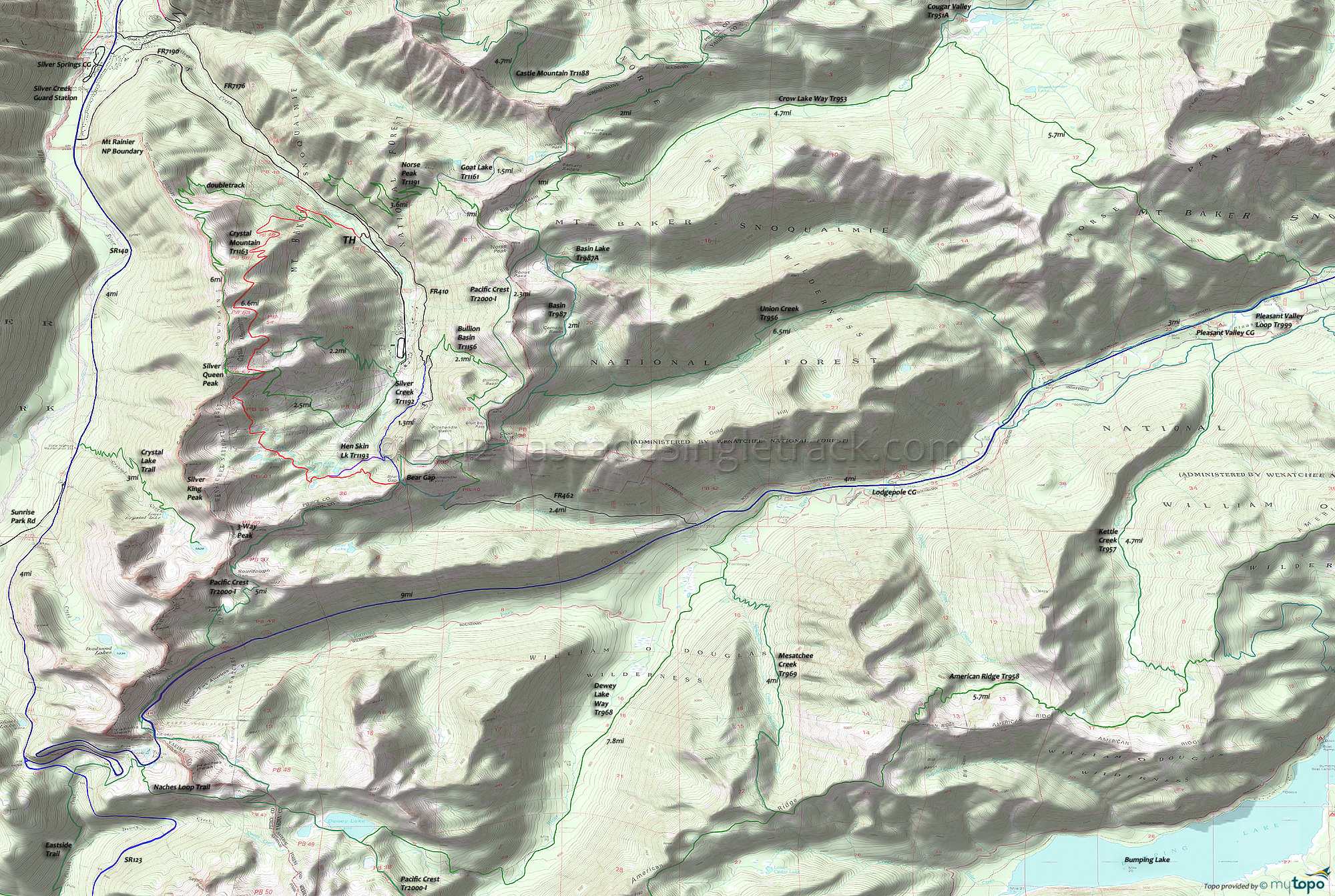
Crystal Mountain Trail 1163 and Norse Peak Trail 1191 Area Mountain Biking and Hiking Topo Map
Twitter Search
#PacificCrestTrail
Map includes Bullion Basin Trail 1156, Crystal Mountain Trail 1163, Hen Skin Lake Trail 1193, Norse Peak Trail 1191, Pacific Crest Trail 2000-I, Silver Creek Trail 1192 and Union Creek Trail 956.
TH: From Sandy Flats, go left on FR7190 then go .4mi to FR140 and begin the climb (as shown on the profile map). Pass Norse Peak Tr1191 at 1mi and continue climbing FR410.
3mi: At the sharp turn, take Silver Cr Tr1192 (the middle trail). The trail turns to singletrack in .4mi, passes a chairlift (crossing a ski slope), then crosses a bridge at the Silver Creek mine and enters the woods.
4.5mi: Go right (across the creek) at the 4way spur junction. The trail to the left goes to Bear Gap and the PCT Tr2000 (hiker only). Reach Chair-4 at 4.9mi and go left onto the doubletrack trail.
5.1mi: Reach Hen Skin lake and ride around the south side of the lake, then merging with Crystal Mt Tr1163 and ascending to Miners Lakes, bearing right at the fork (5.1mi). Cross the creek and go left at the doubletrack, towards the chairlifts. After 500', rejoin Crystal Mt Tr1163.
7.2mi: Switchback climb to the saddle. At the doubletrack go on the trail to the left, climbing .2mi to the doubletrack (at the boulder field), then go right. Begin the sub ridgeline section, maybe stopping at the Summit House along the way. Go along the ridgetop doubletrack to the chairlift, then pick up the trail behind the chairlift.
8.7mi: Go left at the fork, then begin the steep descent back to the Sandy Flats camping area.
Norse Peak Hiking: The Area map includes the nearby Norse Peak Wilderness trails, with several good day-hike options from Crystal Mountain or SR140.
With easy access from the resort, expect traffic on Norse Peak Tr1191, Goat Lake Tr1161 and Bullion Basin Tr1156 looped with Pacific Crest Tr2000. Bullion Basin Tr1156 south fork is closed due to erosion on the steep terrain.
Crow Lake Way Tr953 and Union Creek Tr956 offer more seclusion and are easily accessible from SR140, with camping nearby.
Draggable map: Map window adjusts to screen size and will respond to touch control. Use scrollbar for mouse control.
No Map? Browser settings and some browser extensions can prevent the maps from appearing. Please see Site Tech


