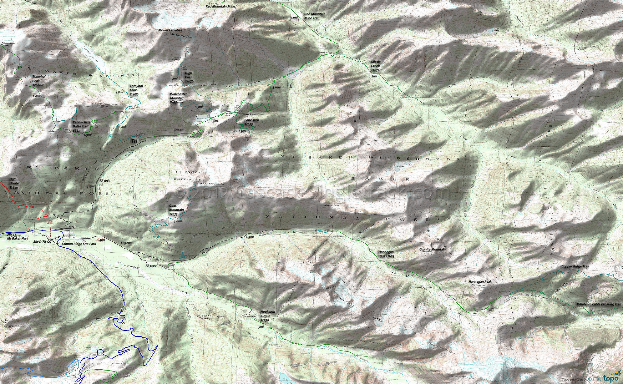
Hannegan Pass Trail 674 and High Pass Trail 676 Area Hiking Trail Topo Map
Map includes: Hannegan Pass Trail 674, High Pass Trail 676, Nooksack Cirque Trail 750, Red Mountain Mine,Silesia Creek Trail 672.1, Tomyhoi Lake Trail 686, Tomyhoi Peak Trail 686.2, Yellow Aster Butte Trail 686.1 Hiking Trails Trails.
Nooksack Wilderness Hiking: North of SR542, this section of wilderness trails extends to Ross Lake (Whatcom Cable Crossing Trail extends to the Little Beaver trails).
Tomyhoi Lake Tr686 was built in the early 1900s by the Gold Run Mining Company, with switchbacks through avalanche chutes and thick brush which leads to a forested ascent to the flat-benched Coyote Flats meadow, with views of the steep-walled reddish Mount Larrabee peak. There are some camp sites at Tomyhoi Lake. Gold Run pass can hold snow well into summer, presenting some avalanche danger.
High Pass Tr676 traverses an avalanche chute beneath Winchester Mountain, then ascends through Low and High Pass, passing the old Gargett mine on the way to Mount Larrabee.
The accessible but steep Goat Mountain Tr673 switchbacks through timber and huckleberries, with views of the icy Mount Shuksan Price Lake (at the base of Price Glacier). Southern exposure usually opens this trail by July.
Nooksack Cirque Tr750 wanders alongside the North Fork of the Nooksack River to the headwaters, in a steep walled cirque at the base of Mount Shuksan. Be wary crossing the often-treacherous Ruth Creek, and avoid this trail after heavy rains or during Spring runoff. Continue past the North Cascades National Park boundary through fierce brush as far toward the cirque as backcountry skills allow.
Hannegan Pass Tr674 ascends the U-shaped glacier carved Ruth Creek valley before crossing the 5100' Hannegan Pass, providing access to the North Cascades Picket Range and Ross Lake, a common starting point for North Cascades National Park hiking adventures. Hannegan Camp spur trail is half a mile below the pass.
The Copper-Chilliwack loop is one of the most popular backcountry destinations in the park, with permits difficult to obtain during busy periods. A backcountry permit is required for all overnight stays. The Copper Ridge trail often has steep snow sections that require an ice axe for safe travel as late as July. Fires are not allowed at any of the Copper Ridge (Silesia, Egg Lake, and Copper Lake camps), Boundary and Whatcom camps. The Chilliwack River Trail has a number of camps along the old growth river valley, starting with Boundary Camp.
Draggable map: Map window adjusts to screen size and will respond to touch control. Use scrollbar for mouse control.
No Map? Browser settings and some browser extensions can prevent the maps from appearing. Please see Site Tech


