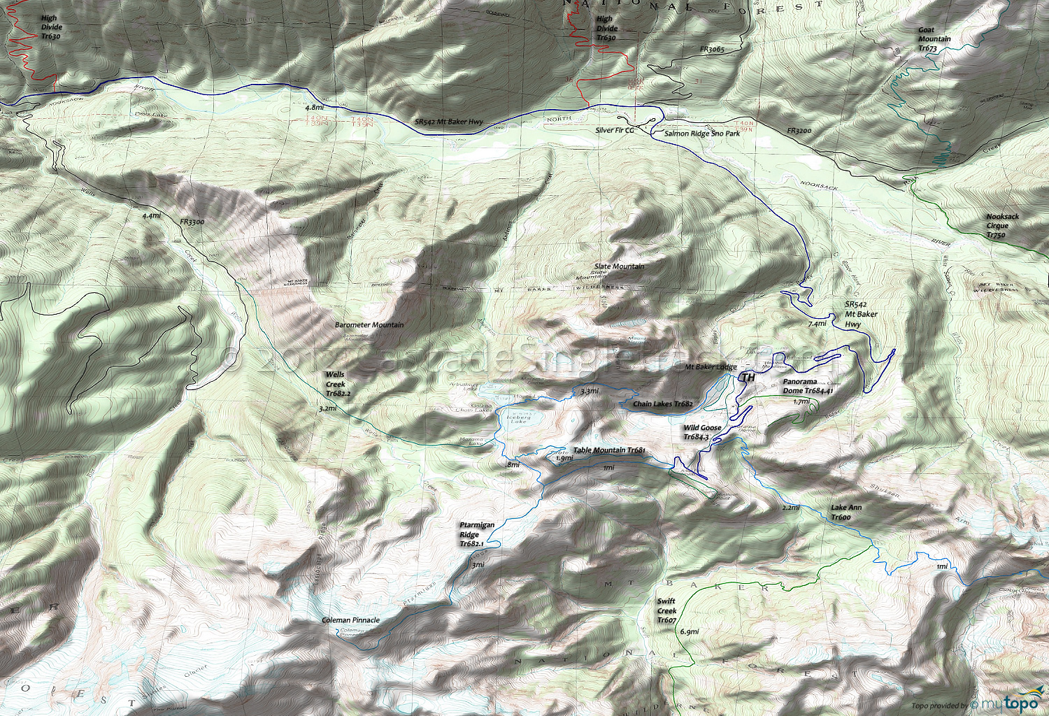
Chain Lakes Trail 682 and Wells Creek Trail 682.2 Area Hiking and XC Ski Topo Map
Map includes: Chain Lakes Trail 682, Lake Ann Trail 600, Panorama Dome Trail 684.41, Ptarmigan Ridge Trail 682.1, Table Mountain Trail 681, Wells Creek Trail 682.2, Wild Goose Trail 684.3 Hiking and XC Ski Trails.
From the Artist Point TH, Chain Lakes Tr682 combines with Wild Goose Tr684.3 to create a challenging 6.2mi (2000' ascent) XC Ski loop, skirting the lava walls of Table Mountain, passing Iceberg and Bagley Lakes, returning in a steep 900' ascent past Heather Meadows
Draggable map: Map window adjusts to screen size and will respond to touch control. Use scrollbar for mouse control.
No Map? Browser settings and some browser extensions can prevent the maps from appearing. Please see Site Tech


